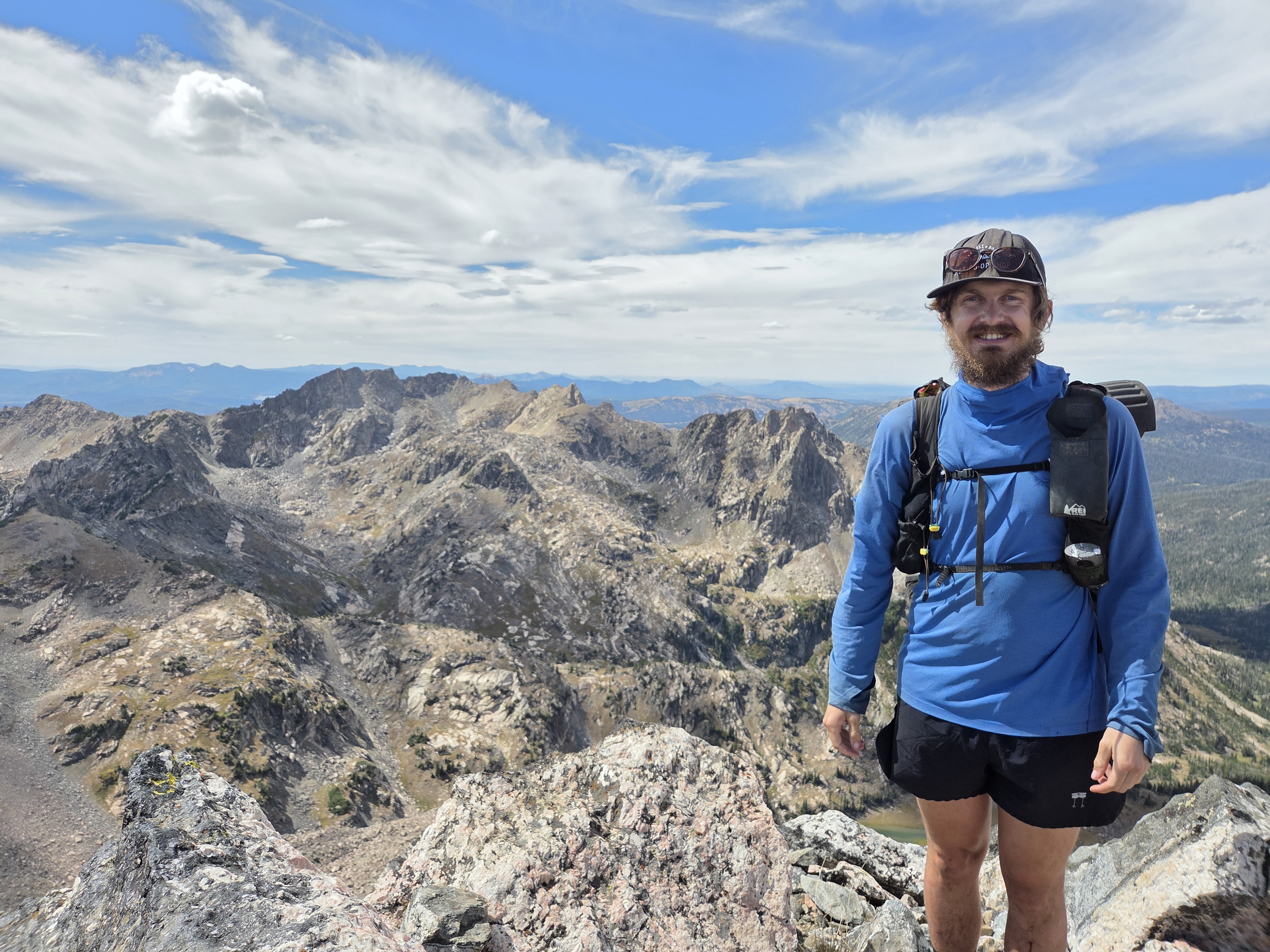
“I’m definitely feeling the cumulative fatigue of the trip, plus the long food carry, so I was struggling just to get to Geneva Lake”
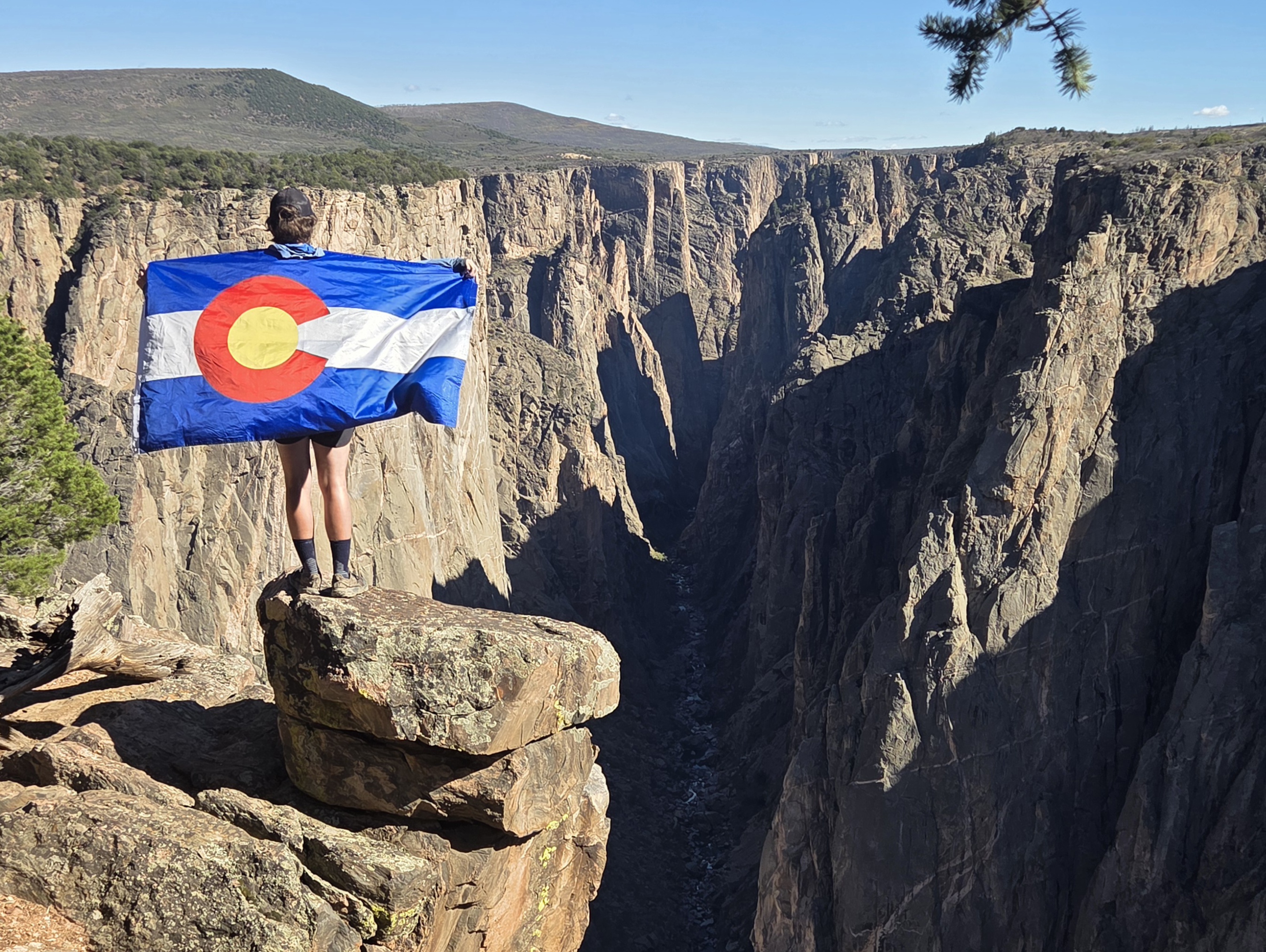
Donovan Rice has now been hiking the Great Colorado Route for 133 days and has walked approximately 1,926 miles.
His accounts during week 19’s hike included a six-day trek through the Maroon Bells-Snowmass Wilderness and Ragged Wilderness, finding titillating scenery at an alpine lake, encountering moose on the trail, and bagging a tundra traverse outside Crested Butte.
Rice is averaging about 14.48 hiking miles/day over the 19 weeks he’s been thru hiking. If Rice hikes 74 more miles, he will have reached the 2,000 miles-hiked figure, placing him a solid 300 miles above his approximated miles-to-hike figure he calculated before the hike.
Leaving Glenwood Springs for the wilderness
Day 127 was a ‘zero’ day in Glenwood Springs for Rice, with a couch crash at a bikepacking friend’s place, including some petting of his friend’s dog Lebowski.
“I met Jay in Silverton way back on Day 49 while I was taking a zero and he was bikepacking the Colorado Trail,” Rice said in his Day 127 social media post. “When you get to Glenwood Springs, I’d love to host you.”
The rest day proved beneficial for Rice since rain had enveloped town and the surrounding mountainsides most of the day. Rice also picked up his permits for hiking through the Maroon Bells-Snowmass Wilderness.
He also resupplied ahead of his hike south toward the second to last wilderness he’d hike through, which perhaps is the most scenic of all of Colorado’s wildernesses.
For Day 128, Rice hiked south out of Glenwood Springs on the Rio Grande Trail, a scenic 42-mile long mixed use trail that follows the Roaring Fork River, upstream toward Carbondale.
Views of 12,602-foot Mount Sopris came into view shortly after he left Glenwood, and they did not disappoint.

“Future folks who don’t care about connected footpaths can bypass by taking the bust to Carbondale or even El Jebel, then up on the of the trails to The Crown,” Rice said.
Once Rice made Carbondale, he kept hiking south on the Crystal Valley Trail that parallels CO-133 for a short while before jumping onto Prince Creek Road.
“I figured this way would be more pleasant,” Rice said. “In the future I might explore a cross country route from New Castle along a sliver of public lands, but below treeline, cross country (travel) can get pretty frustrating, so it is best explored after this initial thru-hike is complete.”
Rice camped at the Lower Prince Creek Campground near Dinkle Lake to end the day.
“Feeling Capitol” in the greatest wilderness of Colorado
On Day 129, Rice began his ascension toward Capitol Peak from Dinkle Lake via Hay Park to the Capitol Creek Trail.
He had more views of towering Mount Sopris to his southwest as he hiked south toward the Capitol Ditch/Capitol Trail TH.
“I debated between hiking Capitol Ditch or Creek Trail,” Rice said. “The Ditch was more efficient, but the Creek had nice views, in my opinion.”

It was a slower-going day for him because the recent rains made the trails muddy. But regardless, Rice pushed on.
One experience Rice missed out on was summiting 14er Capitol Peak, but for good reason.
“I never planned on it in the first place,” Rice said of the decision to avoid summiting one of the hardest 14ers in Colorado. “Doing it was too big of an out-an-back, it looked pretty icy, plus too risky this deep into a thru-hike.”
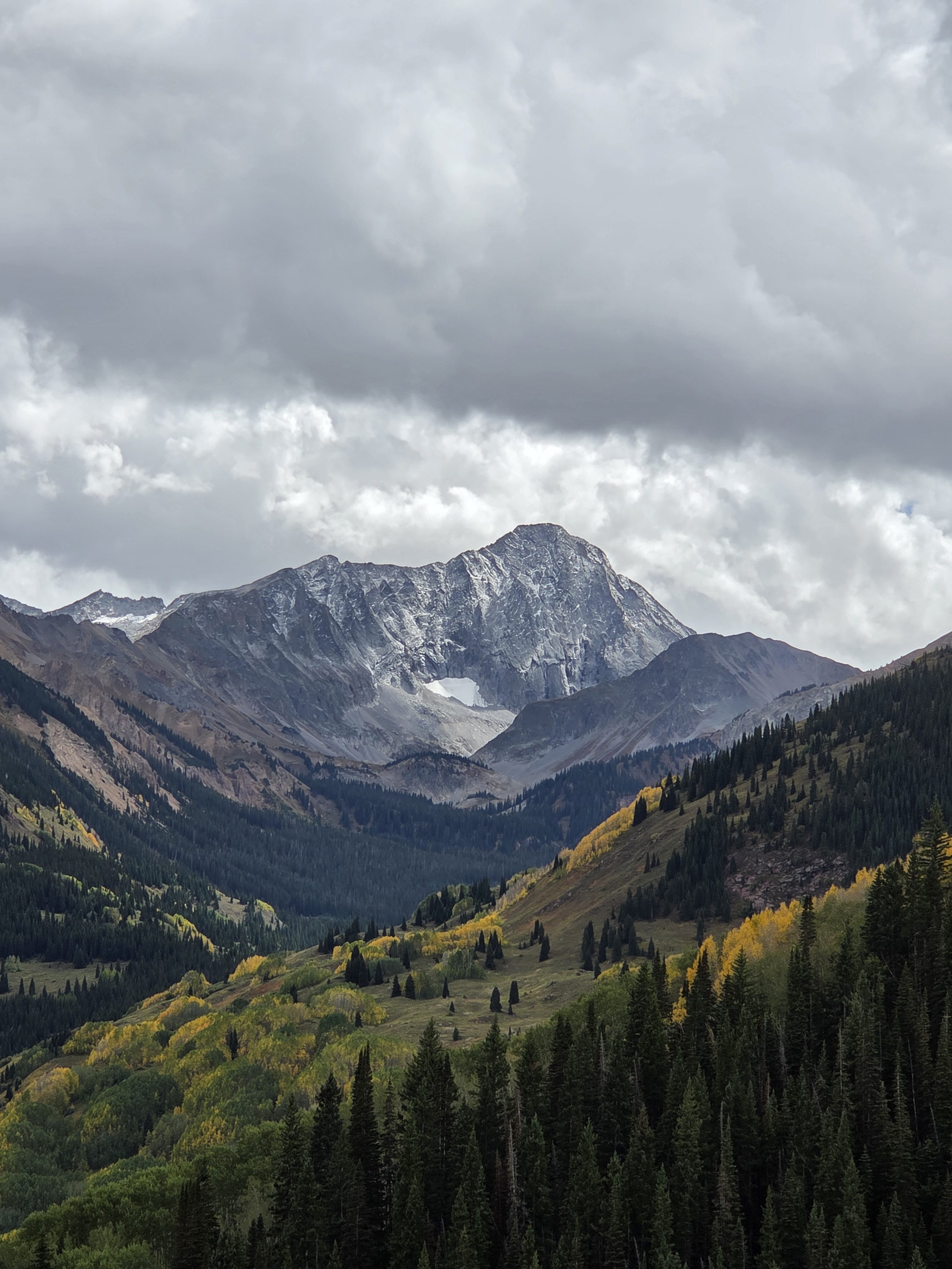
Weather became a factor in the afternoon for Rice anyway, however a stop near Capitol Lake proved to be gorgeous, as was the sunset on Capitol Peak’s northwest face.

“I camped shortly before a hailstorm and got a stunning alpenglow view of Capitol Peak,” Rice said of how the day closed out.
Stunning views abide in the Maroon Bells Wilderness
To start Day 130, Rice was now hiking high into the Maroon Bells-Snowmass Wilderness, walking among some of the most scenic landscapes since entering the San Juan Mountains nearly three months ago.
Rice left the shores of Capitol Lake taking the CL Trail farther south toward Avalanche/Silver Creek Trail. He took a side hike to Avalanche Lake before continuing onward to the Snowmass Mountain massif.

“I went past Capitol Lake and found stunning views along the western side of Capitol, Snowmass, and Siberia peaks,” Rice said. “This is a quiet part of the wilderness not many people get to, and honestly I think has better views than some parts of the Four Pass Loop.”
Rice noticed he could have detoured down Arkansas Mountain Trail taking him west into Marble, Colorado, another small mountain town he wanted to visit, but low and behold, he couldn’t swing it.
“If I had gone, from Marble I would have taken the road past Crystal Mill to reconnect,” Rice said. “Next time.”
But he also said he was really starting to feel the fatigue of the trip, plus the long food carry wasn’t helping him either, as he struggled some to reach Geneva Lake by day’s end.

At least he closed out his night camping with another round of stunning alpenglow views of Snowmass Mountain and the lake.
On Day 131, Rice woke up to frost at his campsite.
He headed back into the alpine over Trail Rider Pass, one of the Four Pass Loop passes in the Maroon Bells-Snowmass Wilderness, passing by Snowmass Lake as he continued his hike.

“Snowmass is my favorite 14er since it throws everything at you: backpacking approach, bushwhack, scree, talus, snow, ridge scramble,” Rice said. “Plus, one of the best sunrise views in the state looking over the ridge toward Capitol Peak and Pierre Lakes.”
Unfortunately, summiting Snowmass Mountain was not on the day’s menu for reasons similar to why Rice avoided summiting Capitol Peak.
Once past Snowmass Lake, Rice ascended up and over Buckskin Pass, allowing him access to Crater Lake after hiking through Minnehaha Gulch.

“Buckskin Pass is one of my favorite vistas of the entire trip,” Rice said. “Great views of Pyramid, the Bells, Snowmass, and all the other mountains no one else cares about because they aren’t above 14,000-feet-of-elevation.”
Because Rice eventually reached Crater Lake and Maroon Lake, he was also rewarded with more views of a Colorado classic; the Maroon Bells.

“I swung by Maroon Lake to get the classic ‘Most Photographed Spot in Colorado’ shot,” Rice said. “I was tempted to bail to Aspen, but it’s such a headache getting back to Maroon Lake.”

Wildlife have the right of way, yeah?
The day’s fun wasn’t complete yet either as Rice pushed back into the alpine from Maroon Lake.

“While working up West Maroon Trail I had a close encounter with a bull moose,” Rice said. “I was looking down at my phone recording notes, and next thing I knew there’s a moose 20 yards ahead. He wanted down the trail and didn’t seem to appreciated that uphill traffic was the right of way.”
To close out the day, Rice camped along West Maroon Trail between Crater Lake and West Maroon Pass.
Finding Paradise and Rubies in the clouds
Up and over West Maroon Pass was how Rice started Day 132, but he did have to deviate some from his planned main GCR route.
Instead of taking West Maroon Trail all the way to Schofield Road to Schofield Pass, Rice detoured at Schofield Trail to the famous Trail 401 to Schofield Pass, avoiding some road walking.
At Schofield Pass he linked up with Paradise Basin Road and set his sights on Paradise Divide, an area that intersected with the Yule Pass TH.

“At Paradise Divide, it was looking pretty overcast, plus I was really tired,” Rice said. “I got a forecast: storms later today and tomorrow. If it had been clear tomorrow, I would have camped at Paradise Divide and then done the Ruby Range Traverse the next day.”
Opting to not chance possible ‘icky’ weather, Rice decided to descend from Paradise Divide down Slate River Road, which according to Rice “gave stunning views of the Ruby Range.”
At the old mining town of Pittsburg, Rice ascended up Poverty Gulch Road some before calling it a night below Cascade Mountain in the meadows of Poverty Gulch.

“Just before camp I got hit with a really nasty but brief burst of high winds and strong rains,” Rice said. “The kind (of storm) where an umbrella does no good. I was very happy to not be on the ridge, and I don’t think I would have had the energy to make it to Oh Be Joyful Pass (anyway).”
A titillating tale in the wilderness outside Crested Butte
For Day 133, Rice made his way closer to Crested Butte by taking another alternative route, the low Ruby Range route, which went up and over Daisy Pass to Oh Be Joyful Creek, then onto Daisy Pass Trail to Scarp Ridge to Gunsight Pass.

Scarp Ridge became another tundra traverse Rice was able to hike while in the Raggeds Wilderness.

“If I had more food, time, battery, and energy I would have taken Yule Pass Trail deeper inside the Raggeds Wilderness to Oh Be Joyful Pass,” Rice said. “I can always revisit that later.”
A sight for sore eyes
After rejoining Daisy Pass Trail below Oh Be Joyful Peak, Rice decided to stop off at nearby Blue Lake for a quick side quest.
When he arrived at the lake, Rice found its views to be scenic.
He also stumbled across a titillating view swimming in the alpine waters as well; a friendly reminder that sometimes side quests net naked beauty on your hike!
“I think I’ll keep this moment to myself,” Rice said when asked if any other details could be shared.
For the remainder of the day, Rice stayed high along the Scarp Ridge all the way to Gunsight Pass before descending into the Slate River valley.

Rice camped outside of town in the River Flat BLM campsites along the Slate River.
“I’ll make it into Crested Butte tomorrow morning,” Rice said. “I’ll walk the last little bit into town along Lower Loop and Woods Walk Trails, perhaps get a coffee at Camp 4 Coffee since the name goes along with the thru-hike theme.”

What’s ahead for Rice
Rice will start week 20 with a ‘nero’ day then a ‘zero’ day in Crested Butte before venturing west out of town back into the West Elk Mountains and up either Mill Castle or Mill Creek toward Swampy Pass.
From there, Rice’s plans hinge some on weather, some on pace, but a visit to West Elk Peak and the The Castles are on his mind.

The West Elks Wilderness will be the last wilderness he will hike through before exiting back into sage brush country near Needle Rock east of Crawford, the first town he stopped in at the beginning of the hike in mid May.
This also means, he is nearing the end of the Great Colorado Route.
He should be back to Black Canyon of the Gunnison National Park and the terminus sometime between Sept. 29 and Oct. 1.
“I might finish at Exclamation Point, ending on an EXCLAMATION POINT,” Rice said.
In his own words
Most satisfying moment from week 19
- “My most satisfying moment this week was trekking across the Ruby Range,” Rice said. “Beautiful mountains and trails that get overshadowed by its neighbor.”

Most challenging moment from week 19
- “The biggest challenge this week was the bike path up the Roaring Fork Valley in the heat with six days of food on my back,” Rice said. “I should have resupplied in Carbondale.”
What he’s learned from week 19
- “My biggest lesson this week was that there’s a whole western side to Maroon Bells-Snowmass Wilderness that few people explore, like Mount Richey,” Rice said.
Discover more from Rocky Mountain Journal
Subscribe to get the latest posts sent to your email.