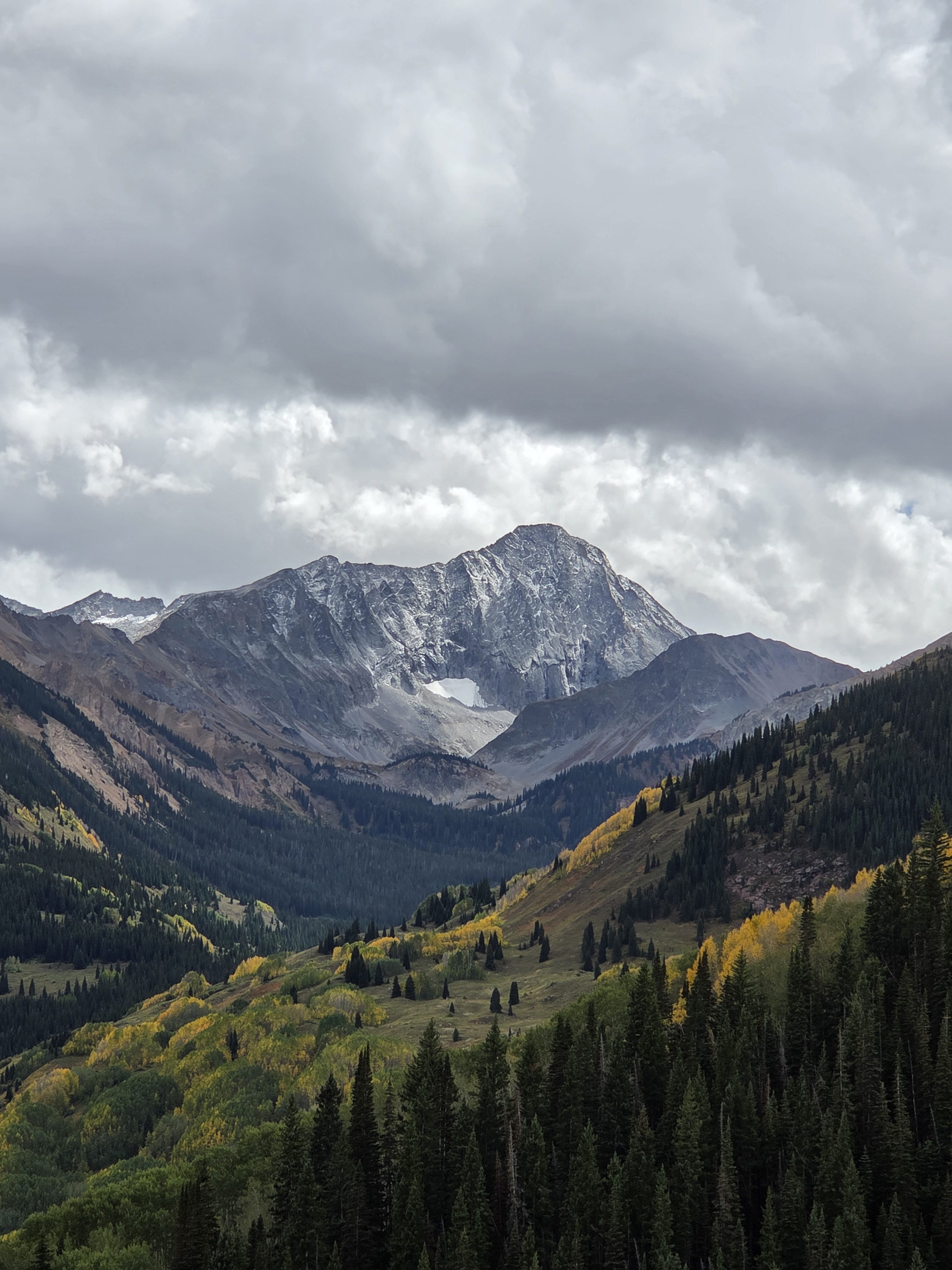
“It is surreal being done. My cup is full, but that was one hell of a trek”
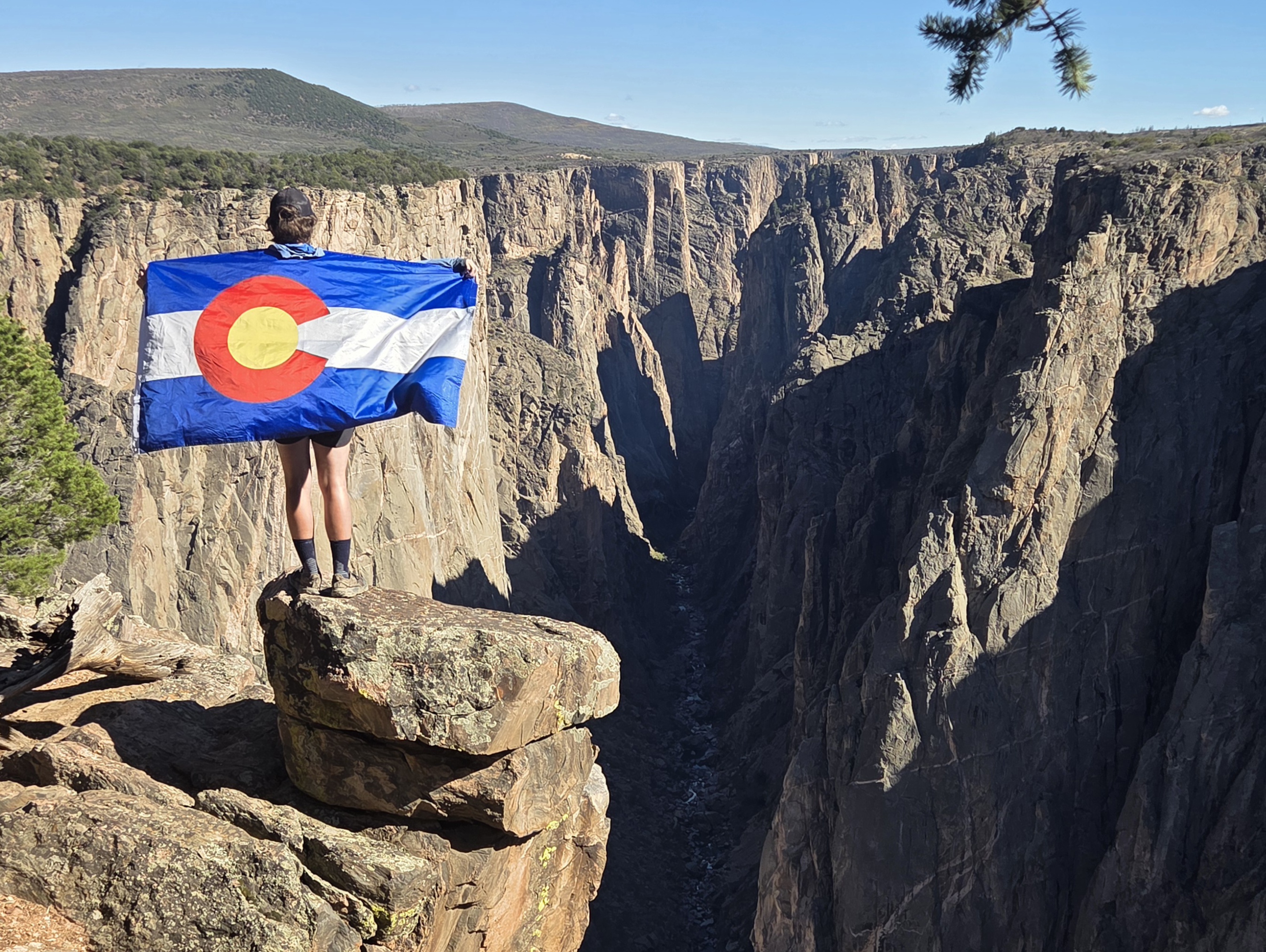
On May 14 Donovan “Iceman” Rice took vantages from Chasm View and Exclamation Point in Black Canyon of the Gunnison National Park as he embarked on an thru-hike odyssey into Colorado’s high country.
Over the course of 141 days he hiked approximately 2021 miles, summited 12 fourteeners, visited all 11 national forests in the state, hiked through three national parks, experienced dozens of mountains ranges, walked along hundreds of trails, and saw countless wildlife.
On the afternoon of Thursday, Oct. 1, Rice approached those two same spots he had started at 20 weeks earlier with a grand sense of accomplishment on his mind.

“It was just my mom,” Rice said about who was greeting him at his destination. “That and a couple of nice folks who I met at the park, plus a climber who did a good job of keeping me humble by being all pish-posh about the feat.”
Regardless of who showed up to greet and celebrate with Rice at Black Canyon, the 29-year-old Golden man walked into the national park with a smile on his face and a sense of relief.

“My friend was saying he was super stoked while chatting on the phone about five miles from the national park,” Rice said. “I said ‘let’s not count our chickens before they hatch,’ road walking is probably the most under appreciated danger of this route.”
But even at the end of the route, Rice found time to make a fun gag with a wilderness use permit for the park rangers, saying his Date and time trip begins was 5/14/26 and Date trip ends was 10/1/26, plus a note at the bottom that reads, “141 nights around Colorado, Great Colorado Route. Sorry it took so long to get back to you!”

Rice said he spent a large majority of his time just focusing on getting to the next town while out on the thru-hike. But now that he is done, he said he can catch a breath, think back on the hike with “woah, I did that?” moments for a bit, and take some time to decompartmentalize the whole experience and appreciate the totality of the ground he covered.
“It is surreal being done,” Rice said. “My cup is full, but that was one hell of a trek.”
Week 20 Recap: One, Last, Push
Rice’s last week of hiking started in Crested Butte on Sunday, Sept. 27, after resupplying in town and resting up the prior two nights.
But before he left Crested Butte for the wilderness, on Friday, Day 134, Rice hiked the remaining five miles into Crested Butte from his camping spot in Poverty Gulch along the Slate River for a ‘nearo’ (near a zero) day.

“I took the Lower Lower Loop Trail to the Woods Trail along the Slate River past Peanut Lake into town,” Rice said of his easy morning hiking.
Rice first backtracked a short distance, then went over the Gunsight Bridge to connect to the Lower Lower Loop Trail, gaining scenic views of Crested Butte and the Slate River valley. Rice was rewarded with a hike through some aspen tree groves on the Woods Trail shortly before reaching town.
“I swung by Camp 4 Coffee for breakfast, then hung out in the town park for several hours while figuring out a place to stay for the night,” Rice said.
After doing some chores in town, Rice managed to hear back about where he was going to be staying in Crested Butte.
“Almost bit the bullet on a pricey hotel when I got the word that a friend of a friend of a friend was cool to host me in his camper parked outside his house,” Rice said. “My dad’s friend Katie used to live in CB. She hit up all her friends and Craig said sure! Rad dude. Treated me to fresh venison for dinner and watched Dark Wizard docu-series.”
On Day 135, Rice took a ‘zero’ day in Crested Butte. He spent most of the day planning the last stretch of the thru-hike from Crested Butte to Black Canyon of the Gunnison National Park.
“I ate breakie at Paradise Cafe, dinner at Secret Stash Pizza,” Rice said. “Not much beyond that, other than the food bag inside the house the night before.”
The story goes, Rice, the night of Day 134, made the mistake of sleeping with his food bag inside the camper he was sleeping in the night before trash day.
Rice had a visitor in the middle of the night come knocking on his door.
“I had to shoo away a bear in the middle of the night,” Rice said. “No biggie, just an oversized raccoon.”
Time to enter the West Elks
For Day 136, Rice said goodbye to “the Last Real Mountain Town,” in Colorado anyway, by hopping on the Green Lake Trail and headed west toward Mount Axtell.

“I swung by Green Lake, which had nice views of Mount Axtell, then joined Carbon Trail 436 to Ohio Pass Road to Swampy Pass Trail,” Rice said. “From there, it was onto Little Pass Creek Trail.”
Fun facts about the West Elk Wilderness
- Size and Rank: It spans 176,412 acres inside the Gunnison National Forest, making it the fifth-largest wilderness area in Colorado.
- Elevation Range: Elevations climb from 7,000 feet up to over 13,000 feet.
- No Fourteeners: It lacks any 14,000-foot peaks (fourteeners) or crowded alpine lakes, which helps keep human traffic very low compared to neighboring ranges.
- “The Castles”: Past volcanic activity carved ridges into 500-foot-tall, castle-like turrets, pinnacles, and crenellated bulwarks known as The Castles.

Because leaf peeping season was in full swing, Rice acknowledged his own fault for choosing to hike on the busy Ohio Pass Road, but the views were still splendid.
Storming the Castles
On Day 137, Rice left his camping spot along Little Pass Creek Trail and found his way to Mill Castle Trail in a meadow on the West Elk Wilderness boundary.
Rice had now rejoined the planned GCR route and began hiking southwest into the last unvisited Wilderness he’d hike through on this maiden thru-hike.
“I went over Storm Pass first,” Rice said of the day’s plans. “But no side quest up West Elk Peak since I’d already been up there before and the views of the The Castles from Storm Pass are better anyway.”

After Rice cleared Storm Pass, he found a social trail up North Baldy Mountain and followed a mellow ridge across Middle Baldies (12,703-foot Middle Baldy and 12,592-foot Middle Badly Mountain).

“This was the last time I went above 12k in elevation,” Rice said.
Rice made a sharp turn at the bottom of Middle Baldy Mountain and followed the Sun Park Trail to Rainbow Lake Trail.

Rice camped for the night near the intersection of the Rainbow Lake Trail and the Sun Park Trail.
“The Castles are an absolute gem,” Rice said. “Doing the Mill Castle Loop is a severely underrated trail for leaf peeping.”

Singing, and hiking, in the rain
When Day 138 dawned, Rice started the day’s hike in a constant battle with rain for the majority of his time on trail.
“It made for muddy trails,” Rice said. “The West Elks already get pretty muddy as is, leading to a confusing web of cattle trails from heavy grazing and soil erosion.”

But he pressed onward northwest on the Rainbow Lake Trail to the Soap Basin Trail. He then followed the Soap Creek Trail northwest through the forest and along Soap Creek, eventually connecting to the Elk Basin Trail at Little Robinson Cow Camp.
“I should have followed COTREX instead of Gaia or Caltopo, because the Coal Basin Trail on those apps was difficult to follow,” Rice said. “I slipped in mud and whacked the ground pretty good at one point, but also got cool foggy views of Mount Gunnison and fall colors underneath.”

Rice spent a good chunk of the day hiking through Elk Basin, grabbing even more moody views of of foggy mountains and yellow aspen trees changing in the late September air.

By day’s end, Rice had hiked just shy of the Curecanti Trail, between Kaufman Ridge and Curecanti Pass, where he set up camp for the night.
“I’ll be honest, IDK what the best combination of trails are in this area,” Rice said. “Just doing what seemed cool on a topo map and will explore other options in the future.”
On Day 139, Rice woke up to drier conditions, ones that would last throughout most of the day, as he made his way up the Curecanti Trail and over Curecanti Pass to link up with the Sink Creek Trail, then the Lone Pine Trail.

“I found some great views along Sink Creek Trail and Lone Pine Trail,” Rice said. “Kinda surreal to see the mountains melt into the valley floor as I approach the end.”
By joining up with the Sink Creek Trail, Rice was back on his planned GCR route that would take him to Needle Rock just east of Crawford, Colorado.
However, Rice didn’t stay on the planned GCR route too long. He turned back southwest at the Throughline Trail and Lone Pine Trail intersection, hiking toward Needle Rock Road to close out the West Elk Wilderness.
“I decided against hiking Little Elk Basin Trail to Little Coal Creek Jeep Trail since I wasn’t certain if the exit was public access,” Rice said. “The road crosses private property (Hawks Nest Ranch) and is extremely reminiscent of the problems I had in other sections of the GCR.”
Rice found camping near Needle Rock to close out the day’s hike.
The push to the finish line
For Day 140, Rice’s second-to-last day on trail involved a sidequest hike to experience Needle Rock, in the rain and fog, before taking his time walking the last few miles into Crawford to rest up for the easy hike to Black Canyon of the Gunnsion National Park the next day.

“Needle Rock is a cool volcanic plug,” Rice said of checking out the rock formation. “One map says Needle Rock is an Instant Study Area, another says it’s a Wilderness Study Area. At any rate, it was pretty cool in the fog.”
Needle Rock, an Instant Study Area, formed approximately 28 million years ago during the Oligiocene epoch when molten magma pushed up into existing sedimentary rock layers as a volcanic plug, neck, or the conduit of a buried laccolith, according to Recreation.gov.
Because Rice only had a few muddy-road miles to Crawford, he took the day in stride, saying there was “no sense hurrying up and waiting in the rain when my ride doesn’t get there (Black Canyon of the Gunnison) until 3 p.m. tomorrow anyways.”
When he did make his way into Crawford, Rice snagged himself his last motel room of the trip, a room at the Hitching Post.
“Clear skies (are forecast) for tomorrow,” Rice said. “Sure beats trudging through the mud and rain (to end the hike).”
Day 141, Rice left Crawford and made his west along Fruitland Mesa Road toward the national park.
The skies were sunny and clear as he joined Black Canyon Road, walking the last few miles to Chasm View, before calling the GCR done.

Waiting for him at Chasm Point was his mom Karen, who drove to Black Canyon of the Gunnison from Golden, to greet, celebrate and welcome her son back from the wilderness. “We have tradition of having her pick me up at the end of these long thru-hikes.”
“Ending the trip with a road walk felt a little silly, but closing the loop and the views for me at Black Canyon reminded me why it was well worth visiting the national park,” Rice said. “Super poetic to end with nothing short of an emphatic Exclamation Point!”
In his own words
Most satisfying moment from week 20
- “My most satisfying moment this week was exploring the western side of the West Elk Wilderness,” Rice said. “Pretty cool seeing the mountains melt into the North Fork Valley.”

Most challenging moment from week 20
- “The biggest challenge this week was the mud,” Rice said. “Rain is an inconvenience whereas mud can be a slippery, scary mess.”
What he’s learned from week 20
- “My biggest lesson this week was how the West Elks are severely overlook for leaf peeping,” Rice said. “Miles and miles of aspen groves.”
To read more stories from Donovan Rice’s 20-week trek along the Great Colorado Route, visit the Rocky Mountain Journal’s Great Colorado Route page here, and watch Rice’s daily recaps on his Great Colorado Route Facebook page here.
Discover more from Rocky Mountain Journal
Subscribe to get the latest posts sent to your email.