“Despite the wind, the views are still super beautiful, including the view of North Park”
Donovan Rice has now been hiking the Great Colorado Route for 119 days and has walked approximately 1683 miles.
His accounts during week 17’s hike included jumping on the NOCO Trail in the Mummy Range, hiking the Medicine Bow Range and crossing North Park, and reaching the northern most point of the entire route near the Mount Zirkel Wilderness.
He also reached the northern most point of the GCR during this week’s hike, but there was a twist on how he accomplished the feat.
Rice’s pace is averaging about 14.14 hiking miles/day over the 17 weeks he’s been thru hiking, an uptick of about 0.3 hiking miles/day this week.
Intense winds, like in Wyoming
To start Day 113, Rice left his camping spot near Blue Lake and headed north toward the Rawah Lakes on the Link Trail after getting rained on in the afternoon of Day 112.
His goal for today was to finish out the Medicine Bow Range and drop into North Park near the North Sand Hills Instant Study Area, and camp near Cowdrey before crossing the expansive valley that is North Park.

“Today, I (then) hopped on the Medicine Bow Trail (part of the NOCO Trail) along the northern Rawah to the Mendenhall Trail in State Forest State Park,” Rice said to the start of his day.
He also said the rocks looked similar to rocks he’d seen a few weeks prior between Colorado Springs and Bailey; the rocks of the Lost Creek Wilderness.
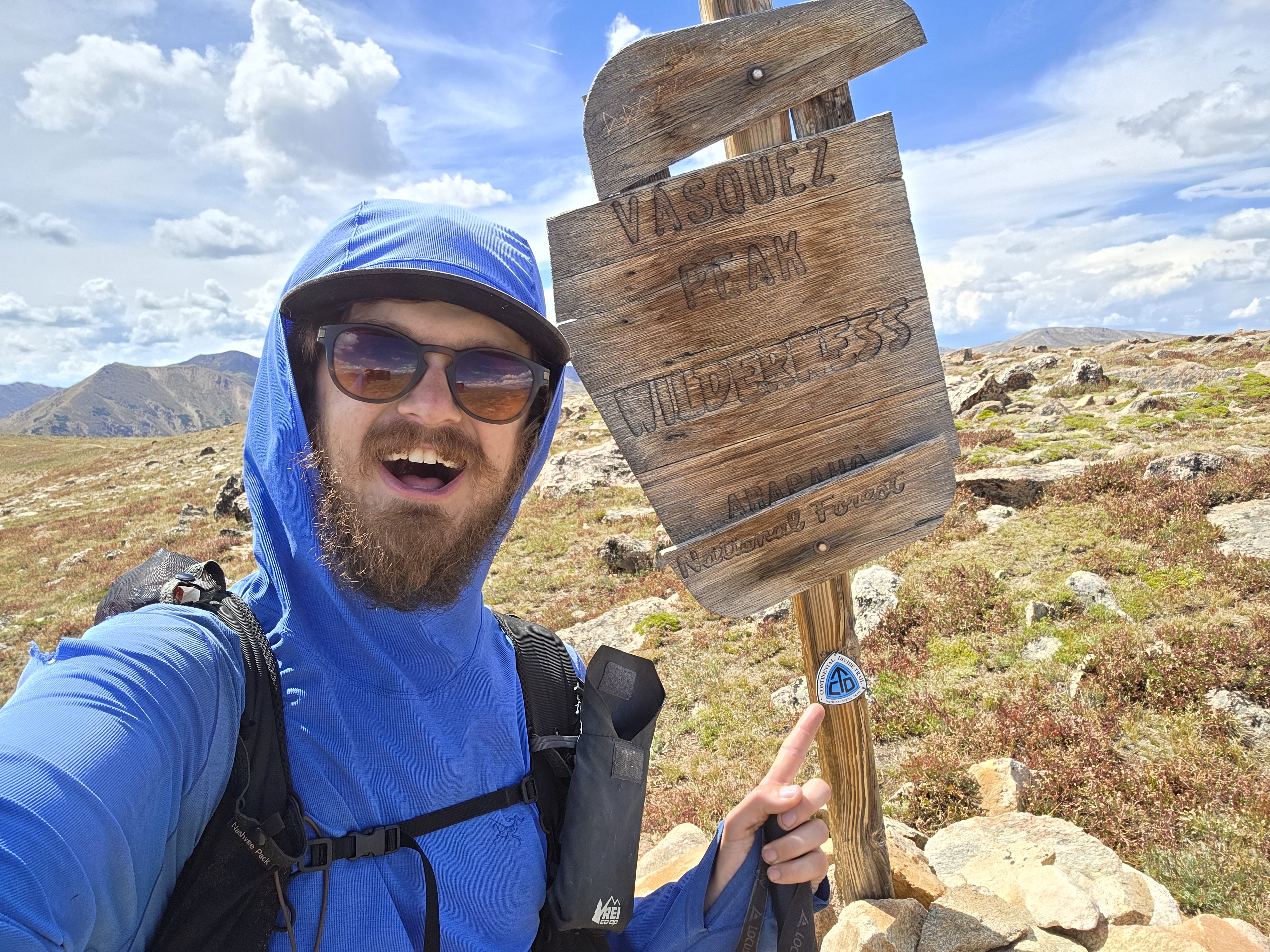
But once Rice reached the ridgeline, winds blowing in from Wyoming met him with some force as his beard and coat’s hood danced around his face while hiking in the northern Colorado wilderness.

“Today I battled some pretty intense winds as I make my way across the Medicine Bow Mountains,” Rice said in his Day 113 social media post. “As I started to get up there (the ridge), I realized it’s going to be another windy day.”
Rice did have some luck on his side, however, as the terrain in this section is far from technical. He simply had to endure the wind most of the day, not worrying extensively about getting blown off a ridge.
“Despite the wind, the views are still super beautiful, including the view of North Park,” he said. “We’ve made it all the way to North Park from Alamosa. How wild is that?”
This part of Colorado is lightly visited and Rice found out firsthand how little presence the trails offer while hiking.
“This is an official trail, and no, they do not maintain it,” Rice said.
At the northern end of the Rawah Wilderness and State Forest State Park boundary, Rice made a turn west and dropped down the pseudo-findable Mendenhall Trail into North Park.
This location, although not extremely scenic, was within 10 miles of the Colorado/Wyoming border, and was to become the northern most point on the Great Colorado Route.
Or was it?

“My dad encouraged me to check out North Sand Hills, so I deviated from NOCO to head that way,” Rice said. “I ended up camping on BLM land just south of the sand hills, but didn’t get to them today.”
The dunes of northern Colorado
Taking his dad’s advice, Day 114 brought about seeing something pretty cool for Rice; the North Sand Hills.

“These were definitely not the most magnificent sand dunes in Colorado,” Rice said, “but pretty cool nonetheless.”
How the dunes formed
- Source of Sand: Strong and steady winds gathered loose sand and sediment derived from nearby eroded rock formations, such as the sandy deposits of the local North Park and Coalmont formations.
- Wind Transport: Prevailing westerly and southwesterly winds blew these fine particles across the wide, open expanse of the North Park structural basin.
- Mountain Barrier: When the sand-laden winds reached the eastern edge of the basin, they hit the steep rise of the Medicine Bow Mountain Range, losing energy and causing the sand to drop and accumulate precisely at the foot of the mountains.
- Cold-Climate Parabolic Dunes: The process created active, U-shaped parabolic dunes that slowly shift and maintain their shape today, uniquely stabilized in part by regional freezing temperatures, snow, and surrounding vegetation.
Rice spent part of the day at the the sand hills before exiting via County Road 6E west into the small town of Cowdrey.
“I then hitched to Walden,” Rice said, where he stayed the night.
While in Walden, he started planning out the next wilderness section he was to hike; the Zirkel Wilderness north of Steamboat Springs.
He would also enter his 11th National Forest, completing his goal of visiting all of the state’s national forests on the this thru-hike.
“I was looking at maps and devised a better plan for Zirkel,” he said. “I will hitch a ride back to Cowdrey the next morning and enter the wilderness near Big Creek Lakes.”
The northern most point of the GCR…finally
For Day 115, Rice left Cowdrey on County Road 6W westbound for a long day’s walk toward the Park Range and Zirkel Wilderness, but it was better than one alternative Rice was looking at.

“Independence Mountain might have been a better route for all reasons expect one: water,” Rice said of his decision to walk the road. “6W had some cow irrigation ditches, which I found preferable to carrying 6L of water, even if it meant sharing the road with cars all day.”
Independence Mountain is a 9,798-foot peak northwest of Cowdrey on BLM land. But as Rice pointed out, potentially lacks reliable water this late in the season and could be a bit slower going as well, hence a NO GO this time around.
One other interesting site Rice saw while hiking on the day was a tiny hamlet at the far northern end of North Park.

“I think I passed by the former copper refinery town of Pearl, roughly one mile south of the Wyoming border,” Rice said.
Pearl, Colorado is an unincorporated ghost town in Jackson County that boomed as a copper-mining hub in the late 1890s and early 1900s. By 1903, the bustling camp included roughly 60 houses, four stores, hotels, a local newspaper, and about a dozen mines producing copper sulfides, silver, and gold.
Since reaching the town of Pearl, Rice had now reestablished the northern most point of the Great Colorado Route, a point he had previously claimed he had reached while hiking in the Medicine Bow Mountains just two days prior.
Rice ended his long county-road walk at the Big Lakes Campground on the eastern edge of the Zirkel Wilderness below 11,404-foot Davis Peak.

The sights of the Zirkels
On Day 116, Rice took off from the Big Lakes Campground area and headed west into the Zirkel Wilderness.
Because he decided to change the route to a further north entrance into the wilderness, Rice now gave himself more time to hike more of the Sawtooth Range as he makes his way south toward Rabbit Ears Pass and Steamboat Springs.

“I took Big Creek Trail to Seven Lakes to Goosenest to start the day,” Rice said. “Then to Mount Zirkel to Red Dirt Pass to Gilpin Lake to Gilpin Creek. It was a perfect weather-day to be above treeline.”
Rice decided to hike up the north ridge of Mount Zirkel instead of only hiking over Red Dirt Pass simply because he had enough cell service to check if the ridge was traversable.

“The north sub-summit to the south true summit was a little techy, and pretty exposed,” he said. “I liked it, but not sure if future folks would.”

After summiting Mount Zirkel (the highest peak in the Zirkel Wilderness at 12,182-feet), Rice caught the Red Dirt Pass Trail and descended into Swamp Park.
“I also debated hiking the south ridge of Zirkel for more direct access to Gilpin Lake (via Gilpin Creek), but Red Dirt Pass and Swamp Park offered stunning views that was worth the extra distance,” he said.
Day 117 brought Rice unfavorable news in the form of less-than ideal weather, but he still had an amazing second day in the Zirkel.

“If weather was perfect, I would have gained Big Agnes Mountain from Gilpin Creek side, dropped down to Mica Lake, then faint trail around Little Agnes to Diamond Park,” Rice said. “But it was rainy, foggy, and extremely windy.”
He ended up taking an alternative out-and-back route, featuring a hike up Gilpin Creek to Mica Lake via Mica Lake Trail, then back down to Gold Creek Lake Trail to the Wyoming Trail to the Continental Divide Trail (CDT).

Rice camped at the CDT/Wyoming Trail junction.
“I have two chiller days to Rabbit Ears Pass starting tomorrow,” he said.
Better to have something than nothing
To start Day 118, Rice continued south on the CDT east of Wolverine Basin, ascending up and over Lost Ranger Peak.

“In the future I might expand the route through the Dome/southern group of mountains near Lost Ranger,” he said. “But I’m not Robert Musil’s “The Man Without Qualities-ing” this. Better to have a finished first draft even if only a first draft.”
Rice spent most of his day above treeline hiking the southern end of the Zirkel Wilderness until he reached Fishhook Lake a few miles north of Rabbit Ears Pass summit.
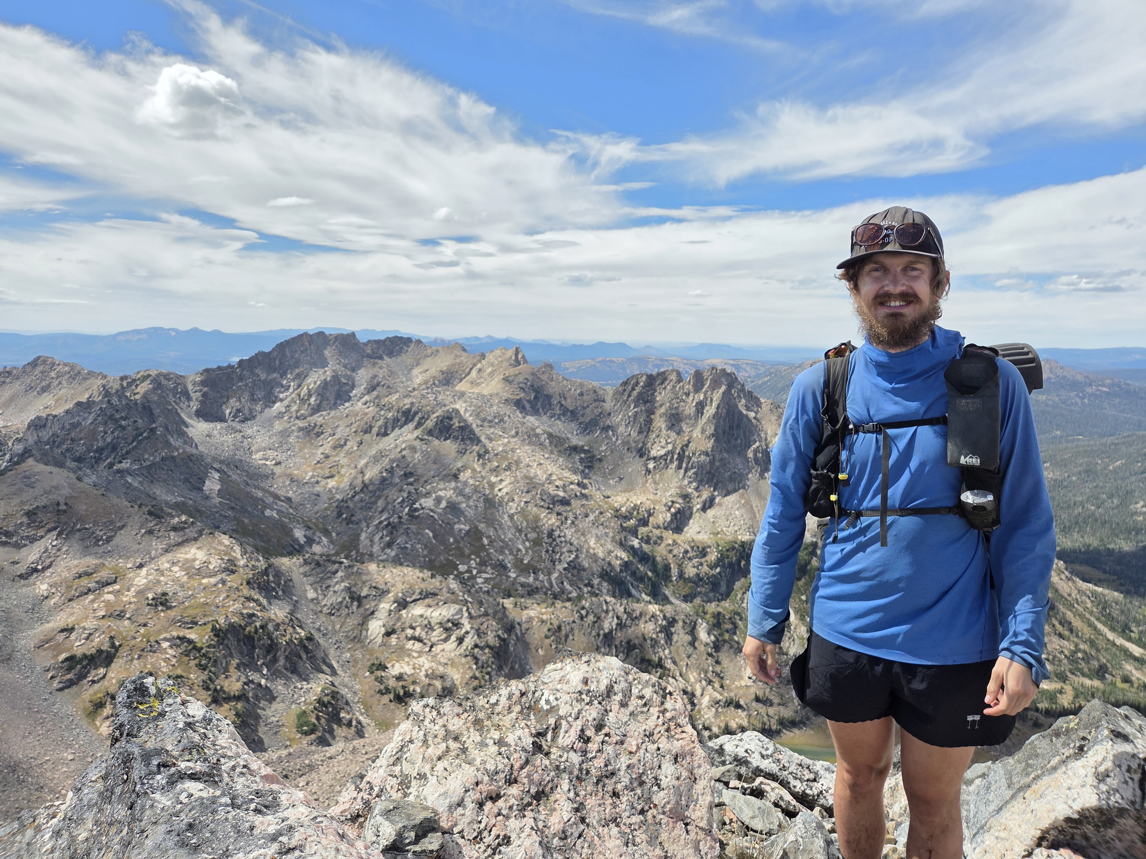
“The Mount Zirkel Wilderness wound up being extremely beautiful,” Rice said. “Being able to go directly over Zirkel is a treat and gives stunning views of the Agnes group.”

Rice also said he hopes to revisit snd hike a loop from Gilpin Creek to Big Agnes to Mica Lake to Little Agnes to Agnes Creek in the future.
For Day 119, Rice continued southward on the CDT from Fishhook Lake, enjoying the wooded forests north of Rabbit Ears Pass before exiting the wilderness onto US-40.
Rice took a slight detour to ascend up the trail to the base of Rabbit Ears Peak before reaching the highway.

“I didn’t rock climb to the true summit (of Rabbit Ears), but did the trail around it,” Rice said. “I guess one of the ears is no more.”
The story goes, in June 2017, a large piece of the western ear broke off due to natural weathering and freeze-thaw cycles.
Because Rabbit Ears Peak is made of fragile pyroclastic material (extruded rock and ash) left behind from volcanic explosions 30 million years ago, it naturally is susceptible to erosion. Steam eruptions during its formation caused internal cracks, making the landmark permanently precarious, albeit unique and beautiful at the same time.
The fallen rock was estimated to be at least as large as two humans (approximately 10-12 feet). Ever since the event, the remaining western ear looks significantly skinnier, pointier, and more fragile than it did before.
Once he reached US-40, Rice hitched a ride into Steamboat Springs to do some chores, including a stop at the post office to pick up a hat and gloves from Smartwool.
What’s ahead for Rice
Rice will start week 18 with a zero day in Steamboat, then hiking southward in the southern Park Range toward the Sarvis Creek Wilderness (which contains no alpine tundra) but is a densely-packed wilderness area with several kinds of fir and pine trees, and copious amounts of wildlife.
He’ll then make his way to Oak Creek to checkout/resupply before entering the Flattops Wilderness and Flattops Mountains on his way southwest toward Glenwood Springs.
“The Oak Creek route looks like more favorable roads, and Kevin from NOCO said he’s likely changing that to the main route for the NOCO Trail anyways,” Rice said of the decision.
In his own words
Most satisfying moment from week 17
- “My most satisfying moment this week was figuring out a way to go up and over Mount Zirkel as a thru-route,” Rice said. “The north ridge was a little spicy, but fun!”

Most challenging moment from week 17
- “The biggest challenge this week was road-walking North Park,” Rice said. “Beautiful country, but not the most riveting hiking. But the payoff was worth it!”
What he’s learned from week 17
- “My biggest lesson this week was knowing how beautiful the northern parts of the Mount Zirkel Wilderness are,” Rice said. “Other long distance trails skip that area.”
Discover more from Rocky Mountain Journal
Subscribe to get the latest posts sent to your email.