National Snow and Ice Data Center scientists report changes in the ice’s thickness is shrinking too
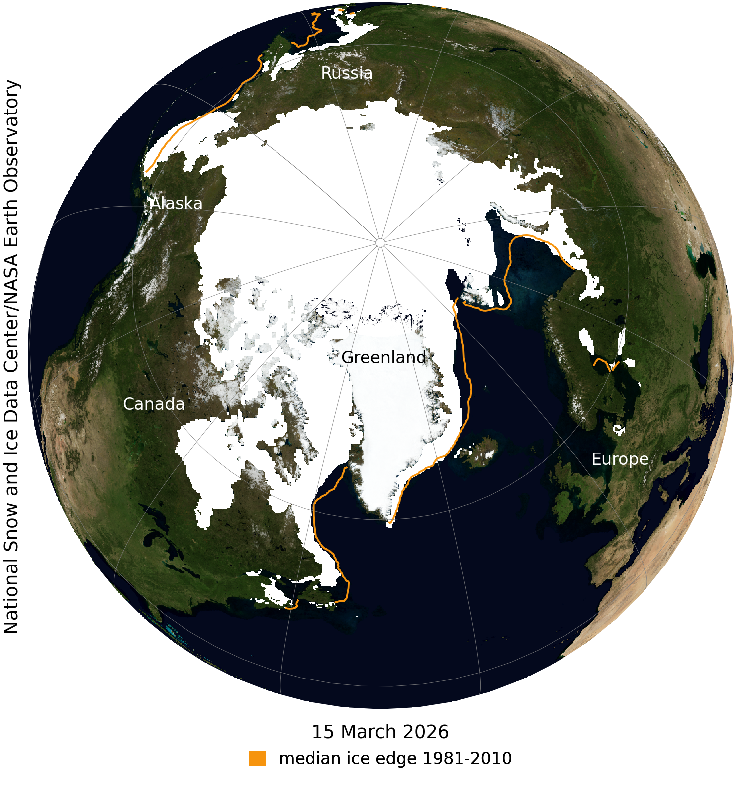
Arctic sea ice likely reached its maximum extent for the year, at 5.52 million square miles (14.29 million square kilometers) on March 15, according to a report from scientists at the National Snow and Ice Data Center (NSIDC) at the University of Colorado Boulder.
This means for the second consecutive year, winter sea ice in the Arctic reached a level that matched the lowest peak observed since satellite monitoring began in 1979.
Sea ice extent is defined as the total area of the ocean with at least 15% ice concentration.

On March 15, Arctic sea ice extent reached 5.52 million square miles (14.29 million square kilometers), very close to the 2025 peak of 5.53 million square miles, according to the NSIDC.
“This record low maximum gives a head start to the spring and summer melt season,” NSIDC Senior Research Scientist Walt Meier said. “One or two record low years don’t necessarily mean much by themselves, but in the context of the significant downward trend that we’ve observed since 1979, it reinforces the dramatic change to Arctic sea ice throughout all seasons.”
This winter, peak ice cover was below the average levels between 1981 and 2010 by roughly 525,000 square miles (about 1.36 million square kilometers), according to the NSIDC.
Along with the overall extent, researchers are also observing changes in ice thickness.
“Based on what we’re seeing with NASA’s ICESat-2 satellite, much of the ice in the Arctic is thinner this year, especially in the Barents Sea northeast of Greenland,” Nathan Kurtz, chief of the Cryospheric Sciences Laboratory at NASA’s Goddard Space Flight Center in Greenbelt, Maryland said. “The Sea of Okhotsk that borders northern Japan and Russia also had relatively low ice this year — a region that naturally experiences significant year-to-year variability.”
Conversely, Antarctic summer sea ice reached an annual low of 996,000 square miles (2.58 million square kilometers) on Feb. 26.
Even though this year’s coverage represents an increase compared to the unusually low levels of the past four years, it is 100,000 square miles (260,000 square kilometers) lower than the 1981–2010 average, according to the NSIDC.
However, the Antarctic sea ice minimum was well above the record low set on Feb. 21, 2023, of 691,000 square miles (1.79 million square kilometers), according to the NSIDC.
NSIDC scientists also said that the Arctic sea ice extent number is preliminary, and that weather conditions could change the annual maximum ice extent further before truly reaching a more exact extent maximum number.
Discover more from Rocky Mountain Journal
Subscribe to get the latest posts sent to your email.