“‘The Tights’ of Grape Creek were super scenic and the trail follows the old narrow gauge railway and offers spectacular views”
Donovan Rice has now been hiking the Great Colorado Route for 77 days and has walked approximately 990 miles.
His accounts during week 11’s hike included trekking from Crestone to Westcliffe over five passes in the Sangre de Cristos, navigating a public access points into public lands SNAFU and tracing the footsteps of Zebulan Pike along Grape Creek to Cañon City.
Sad to see the Sangres go
On Day 71, Rice began with a resupply in the eccentric and quirky town of Crestone. He wanted to experience the hamlet more but had to push onwards to North Crestone Lake by day’s end.
“It’s a really cool community, a lot of spiritual temples and free-spirited individuals,” Rice said in his Day 71 social media post. “And I asked a local, they said, ‘1970s era hippies. That would be the general vibe’.”

Rice had three trail options to chose from to reconnect to the GCR intended route.
Even though he was still tired from the seven-day push from Alamosa to Crestone, North Crestone was the least efficient, but reconnected the furtherest south; the other trails would have bypassed Comanche or even Venable Pass.
“Fewer people get into this part of the Sangres than over by the 14ers, but I still think the mountains are just really exceptional out here,” Rice said.
Day 72 was bittersweet for Rice. It was his last full day hiking in the Sangre de Cristo Mountains.
It was also a big day as he needed to hike over five passes (Comanche Pass, Venable Pass, Unnamed Pass 3, Unnamed Pass 2 and Hermit Pass).

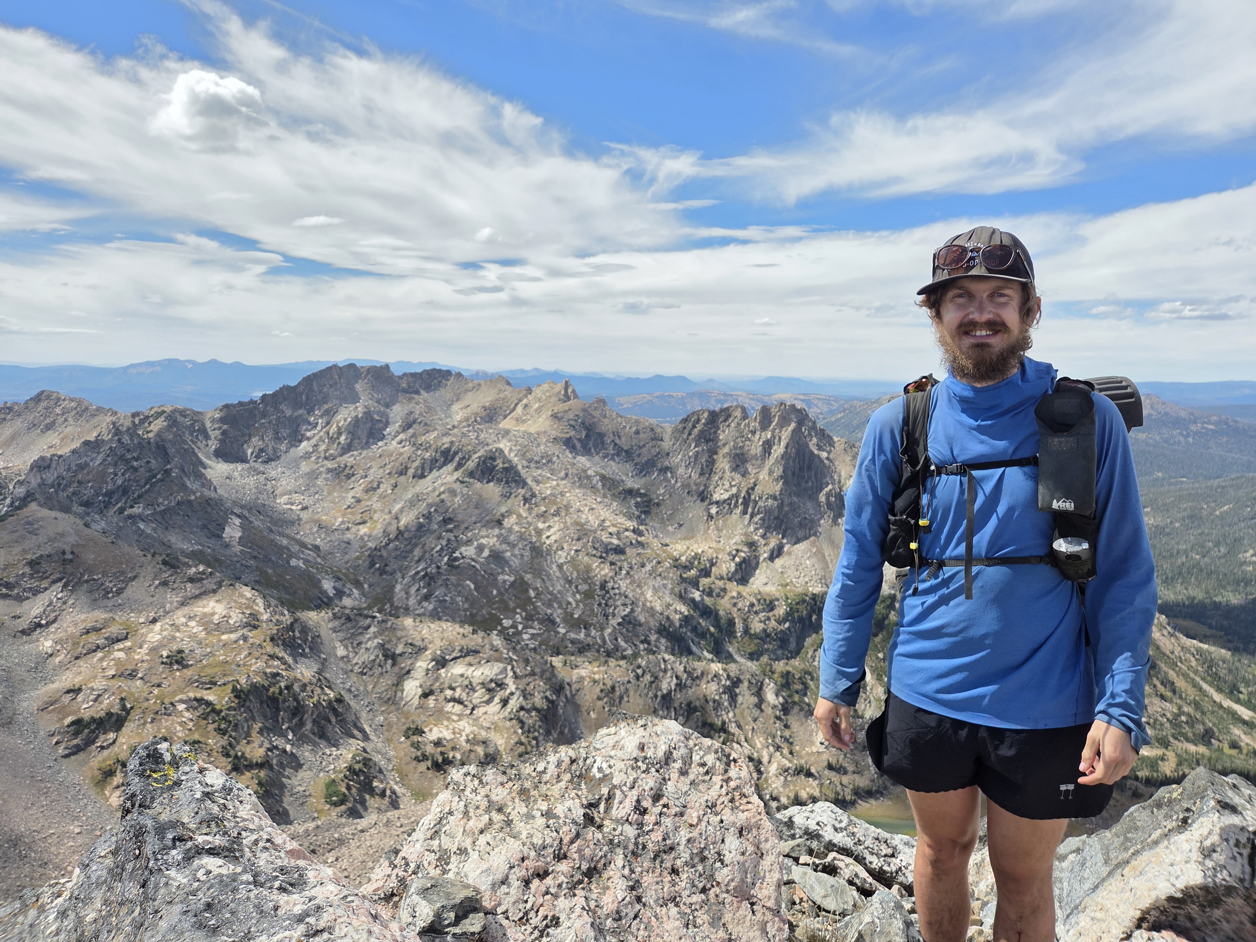
Plus, he summited 13,277-foot Comanche Peak before calling it good at Hermit Lake.
Rice said the ascent to Comanche Peak, then down to the pass was fairly easy, from a cross-county terrain stand point anyway, noting his affinity for the occasional ridge with drop offs on both sides.
“It’s a unique experience seeing tundra on one side and cliffs on the other.”
With Comanche Peak and Pass bagged, it was onto the remaining four passes.
“I then joined the Rito Alto Loop, a popular 4-pass backpacking loop similar to the one around the Maroon Bells,” Rice said. “If I had had more energy and a better weather window, I would have considered just staying on the the ridge all the way from Spring Mountain to Hermit peak.”

Rice said taking the trail was the better choice because he was dead tired even though he was adding elevation descents and ascents into the day’s hike.
“Going over Hermit pass was pretty emotional,” he said. “My last pass of the Sangres and the last time I’ll be above treeline for quite some time (all the way to Pikes Peak).”
Earned rest with family & the SNAFU
Hiking from Hermit Lake to Westcliffe on Day 73 wasn’t too much of a long haul for Rice; a straightforward 12.1-mile journey, mostly on open road.
Awaiting him in the Wet Mountain Valley town was his aunt and uncle, who recently move to the area.
Rice said while walking along Hermit Road the thru-hike will be changing pace.

“The next hundred or so miles are going to be a little different than what I’ve been doing lately,” Rice said in his Day 73 social media post. “We’re going to transition to some of the less intense parts of Colorado as I work my way towards Pikes Peak over by Colorado Springs.”
Rice eventually met up with aunt and uncle and began relaxing as the heat of the day in the valley wound down.
For Day 74 and Day 75, Rice was treated to a visit from his grandparents while taking a “double zero” day break to relax and recharge with even more family.
“They came all the way from Erie to say hi,” Rice said.
Rice also managed to find time to sip a Colorado brewery beer while soaking his aching bones while in Westcliffe.

Situation Normal, All F@#%ed Up
The two days in Westcliffe was not all just hanging out and sitting in hot tubs.
Rice was presented with a possible SNAFU via navigating the public access points into the public lands of the Grape Creek Wilderness Study Area near Westcliffe.

Rice and his family did some research over the 48 hours he was in Westcliffe to solve the problem in front of him.
“We reconnoitered (surveyed) some access points into Upper Grape Creek WSA from Westcliffe,” Rice said. “All I’ll say is that what the BLM promises is public access and what land owners claim is public access are two different things.”
In the end, Rice found a workaround from leaving Westcliffe into Upper and Lower Grape Creek WSAs, at least per what the Royal Gorge BLM office told Rice, he said.
“I’ll see further clarity from the Royal Gorge BLM office in Cañon City for future folks,” Rice said of finding a long-term solution to the public access to public lands issue.
Walking in the footsteps of explorers
On Day 76, Rice left his aunt and uncle’s house in Westcliffe and made his way northeast into Upper Grape Creek WSA following Grape Creek downstream.
“Today was really beautiful,” Rice said. “The temporary solution worked without incident, and the scenery is worth advocating for an easier, unintrusive pedestrian access point.”

Rice said this section of the GCR retraced parts of Zebulon Pike’s footsteps Pike and his men made 219 years ago from Cañon City to Westcliffe.
Rice, however, walked Pike’s route in reverse due to the nature of Rice’s route.
The story of Pike’s expedition goes, by early December 1806, Captain Zebulon Pike’s expedition had pushed into the Royal Gorge, making camp there around Dec. 5, 1806 while searching for the source of the Arkansas River. Pike was also looking for the source of the Red River.
Pike misjudged a low-flowing stream entering the gorge as the river’s headwaters, a mistake that shaped his next moves.

By mid-January 1807, Pike decided to split his party up at Cañon City, leaving Private Patrick Smith and interpreter Antoine Baronet Vasquez behind on January 14 to guard the horses and excess baggage.
The remaining men, each carrying packs of between 45-70 pounds, pushed southwest up Grape Creek into the Wet Mountain Valley in a bid to locate the Red River beyond the snow-covered peaks.
The route through Grape Creek would prove to be one of the most physically punishing legs of the entire expedition.

Privates John Sparks and Thomas Dougherty suffered frozen feet and could no longer travel, while starvation loomed for the whole detachment in the depths of winter.
The ordeal taught Pike a hard lesson about the limits of winter travel through the Rockies without adequate clothing, food, or local knowledge of the terrain. Many of his men were still without proper blankets months into the journey.
Ultimately, the suffering along Grape Creek forced Pike to reassess his approach, leaving injured men behind and adjusting course as he continued his ill-fated search for the Red River into the Sangre de Cristo range and San Luis Valley.
Rice did not suffer the fate of Pike’s men, however.
He said he stopped earlier in the day to camp on ground away from both lightning and flooding.
“No wonder they call these the Wet Mountains,” Rice said.
Day 77 brought about hiking through Lower Grape Creek WSA into Temple Canyon to end week 11.

“The Tights of Grape Creek were super scenic,” Rice said. “The trail follows the old narrow gauge railway and offers spectacular views.”
Near the end of the day, Rice was picked up at Temple Canyon to avoid more nasty weather, then returned the next morning to the same spot to continue his hike from Temple Canyon toward Cañon City.
“In other news, I am now on pair of shoes #3 and socks #3 and 4. Dumped my snow gear with family in Westcliffe,” Rice said.
It is nice to know the man is in good spirits and rotating out bad gear for good.
What’s ahead for Rice
Rice will start week 12 sky high.
“I go the official go-ahead for one-time access to the rear entrance to the Royal Gorge Bridge so I can walk across it as part of my hike,” Rice said. “They said to revisit the topic of future access after the new management takes over in November.”
Rice will continue his hike northward out of Cañon City toward the MOOve Over Trailhead, giving him access to the BLM – Royal Gorge Field Office land.
He’ll then get to cruise along the Copper Mountain Trail on his way toward the old mining town of Victor.
In his own words
Most satisfying moment from week 11
- “My most satisfying moment this week was getting some well-earned rest after 10 demanding days hiking from Alamosa to Westcliffe,” Rice said. “Plus, a shout out to my extended family for hosting and visiting me!”

Most challenging moment from week 11
- “The most challenging moment this week was leaving the town of Crestone without truly experiencing,” Rice said. “The weather window for Comanche to Hermit was better for heading directly out of town versus staying for a rest day. I’ll come back after the trip.”
What he’s learned from week 11
- “My biggest lesson this week was that the government and local landowners don’t always agree on what are public access points to public lands,” Rice said.
Discover more from Rocky Mountain Journal
Subscribe to get the latest posts sent to your email.