“In a perfect world I could float the river all the way to Alamosa”
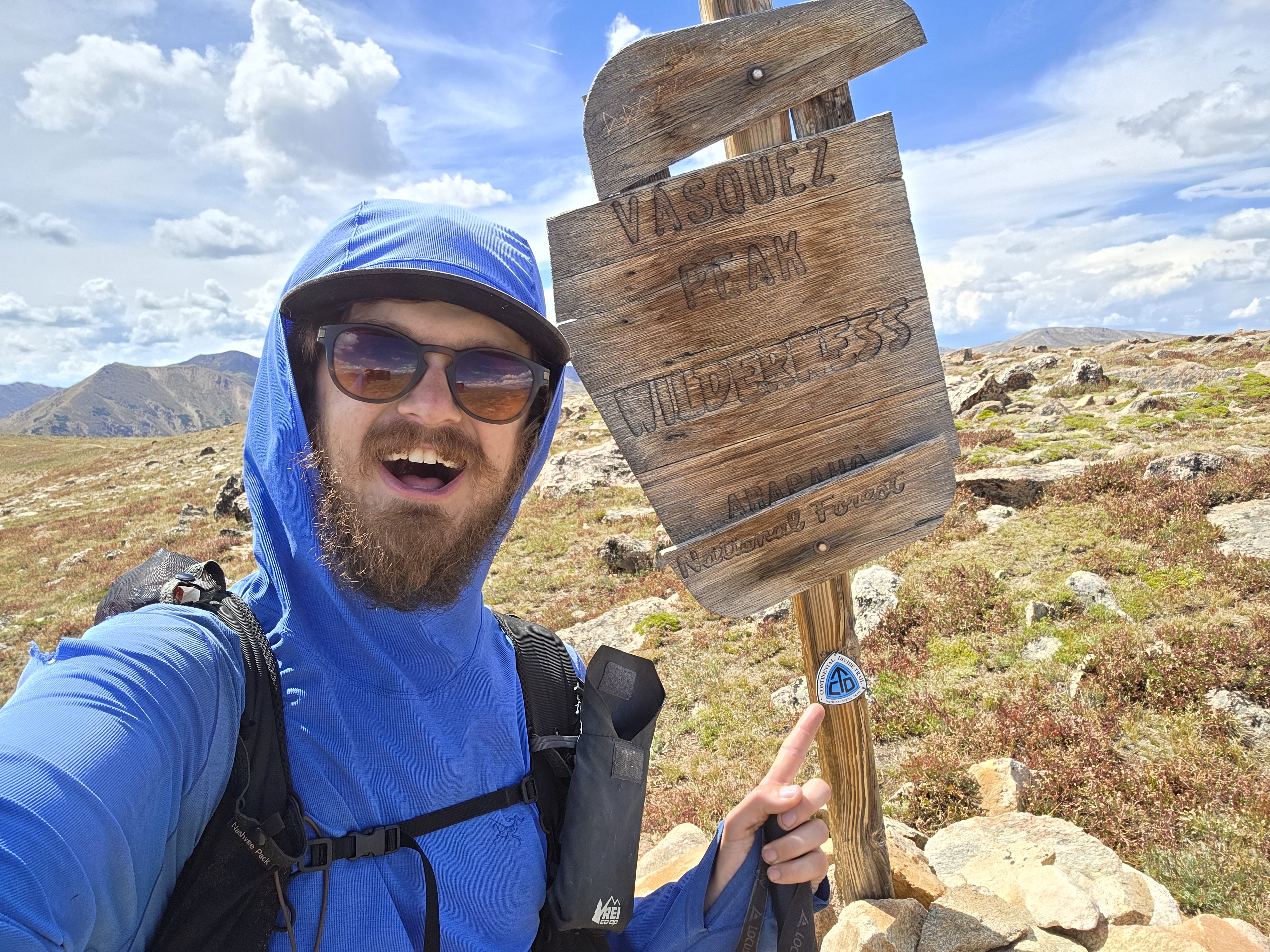
Donovan Rice has now been hiking the Great Colorado Route for 63 days and has walked approximately 825 miles.
His accounts during week 9’s hike included walking 17 miles along the La Garita Ridge Traverse, experiencing the Wheeler Geological Area and packraft floating the Rio Grande River in South Fork.
Rice is about 50% completed with the thru hike. He closed out the San Juan Mountains and crossed the expansive San Luis Valley, heading for the Sangre de Cristo Mountains next.
Rice said he’s been averaging 13 miles per day on trail, a pace slightly ahead of his initial 12.5 miles per day pace to finish the route by the end of September. Rice recalculated his figures and he now needs to average 14.5 miles per day to finish the route by the end of September.
Closing out the San Juan Mountains
Rice began Day 56 by hiking up Baldy Chato, a 13,704-foot peak north of the San Juan Mountains’ eastern most 14er, San Luis Peak. His day-end goal was to finish at the Wheeler Geological Area via a 17-mile long traverse, but he had to cut his day short due to stormy conditions.
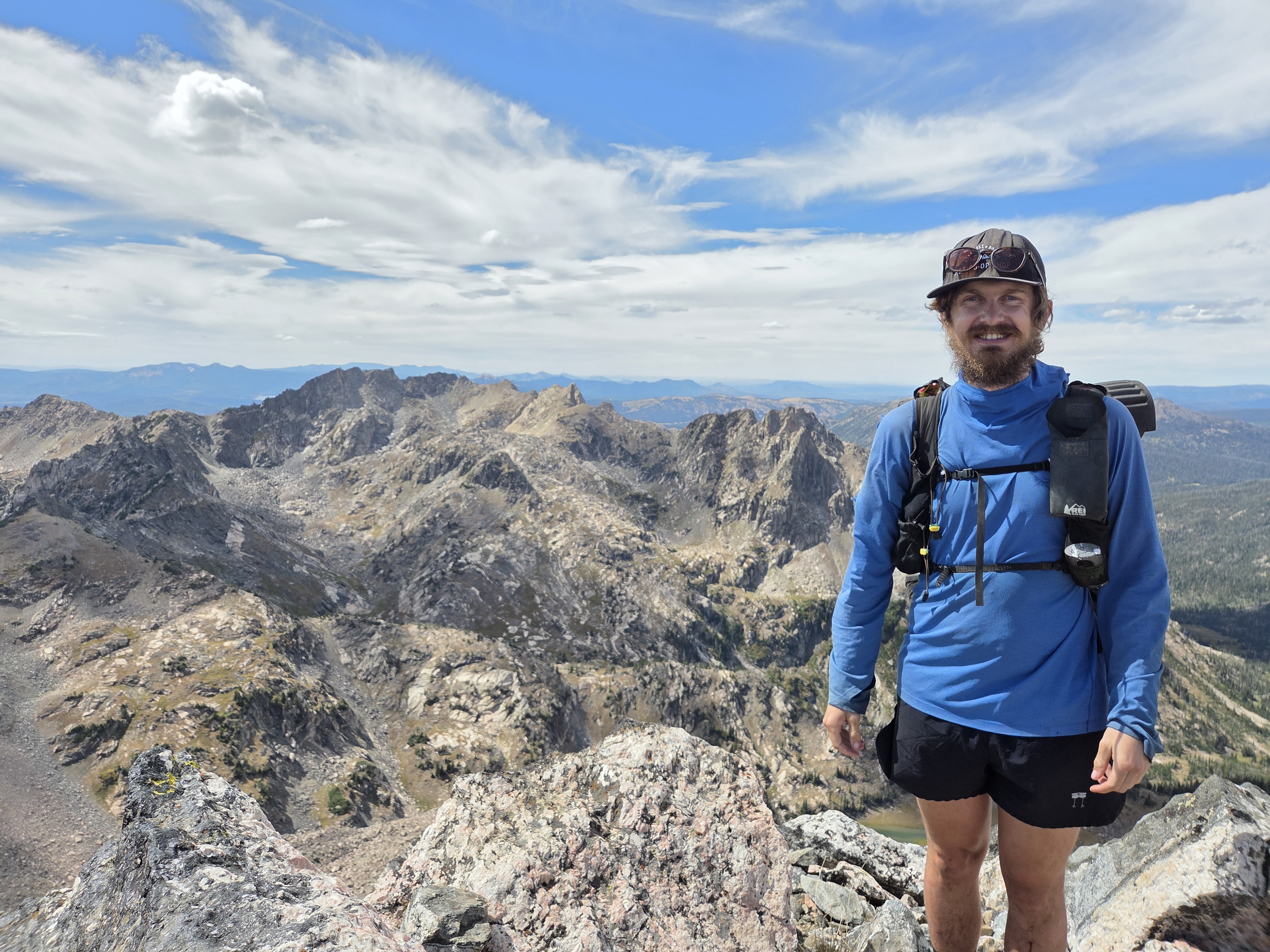
First Rice ascended above treeline and was greeted by multiple cliff bands and spires as he made his way across the 17-mile long La Garita Ridge Traverse.

“The cliffs from Baldy Chato to Baldy Alto were absolutely stunning,” Rice said. “Easy tundra (walking) on one side, dramatic drop offs and spires on the other.”
The La Garita Mountains host numerous cliff bands and spires because they have been carved into thick, highly erodible layers of volcanic ash, aka tuff.
This tuff was deposited by one of Earth’s largest supervolcano eruptions.
The La Garita Supervolcano erupted approximately 26-28 million years ago. However, since becoming extinct, wind, water and other forces have eroded or worn away the rocks, leaving behind the cliff bands and spires Rice saw while hiking.
As the day and Rice continued, he was able to summit San Luis Peak, but didn’t stay very long atop the summit.

Rain and storms had brewed leading into the afternoon, cutting Rice’s 17-mile ridge traverse short.
“Had I done the full traverse in one day I would have been a very tired and very sore hiker,” Rice said.
He opted to camp near Cochetopa Creek along the Colorado Trail.
Trying not to get cliffed out
Day 57 started out with a simple plan: Regain the ridge, make it to Wheeler Geological Area.
“Since it was pretty clear that the ridge after San Luis Pass would go, and I know most folks don’t like backtracking, I scouted a different way to regain the ridge from Cochetopa Creek,” Rice said. “After gaining the ridge, I played around on some cliffs, then rode the ridge all the way to Wheeler.”

Rice also said his favorite experience of the ridge traverse was the part leading up to and after 13,707-foot La Garita Peak.
“The cliffs down to Machin Lake were incredible, and I bet the later-to-come trailed version of the GCR will have great views looking up from the lake,” Rice said.
Further along the trail and at the top of Unnamed Peak 12,860 between La Garita Peak and Wheeler GA, Rice found a unique name on the trail log, dated Sept. 2, 1996.
The name he saw was that of Colorado author and hiking extraordinaire, Mike Garratt, who co-authored the 1992 book “Colorado’s High Thirteeners: A Climbing and Hiking Guide.”

Garratt is known as the first recorded person to officially finish climbing all the ranked 13ers in Colorado, completing the feat on July 31, 1987.
It was finally time for Rice to pass through Wheeler GA, also part of the La Garita supervolcano eruption.
Designated by President Teddy Roosevelt in December 1908, Wheeler Geological Area was Colorado’s first national monument. However, due to its remoteness and low annual visitor visits, President Harry Truman abolished Wheeler’s national monument status in August 1950, changing it to a geological area.

“After working your way around to the front side, that’s when you get the really cool view,” Rice said in his Day 57 social media post. “What a crazy landscape this place is.”
After exploring Wheeler GA, Rice ended the day in the Silver Park area, accessing it via the Wheeler Trail east of Creede.
New friends and a packraft float
Day 58 started out with Rice hiking southeastward toward South Fork via Alder Bench.
Alder Bench’s terrain is similar to the terrain Rice hiked over the prior two days, but is mostly below treeline, which gave Rice some shade as he made his way along the trail.
After cruising on the Alder Bench Trail, Rice utilized the Palisade Trail just north of South Fork to get into town.
Rice completed the day by meeting two new friends, Kyle and Lindsay Bradley, who are according to Rice ‘outdoorsy dirtbags in their hearts but have chosen to pursue greater stability and financial freedom with professional careers.’

“(I was) hosted by the new owners of newly renovated SoFo Pizza,” Rice said. “The sweet chili wings were to die for, and the pizza wasn’t too shabby either.”
On Day 59, Rice took a ‘zero’ day in South Fork with the Bradleys.
“Kyle and Lindsay let me borrow their packraft to float the Rio Grande River through town just for fun,” Rice said. “In a perfect world I could float the river all the way to Alamosa to skip some roadwalking, but alas, private property and river access laws.”

During his down time, a fun topic of debate brewed. He couldn’t get a decisive answer on whether South Fork was a San Luis Valley or San Juan Mountains town.
“Seems the locals lean more towards their SLV neighbors,” Rice said.
Goodbye San Juans, hello San Luis Valley
For Day 60, Kyle Bradley advised Rice to take Rice’s GCR bypass route instead of the main GCR route that traveled next to Beaver Creek Reservoir.
This change took Rice along Church Creek Trail to Beaver Mountain Road before ascending Willow Creek Road to link up to the main GCR route. Rice spent the day hiking “cruisy” trail into the Pinos Creek area as he made his way southeast toward Bennett Peak.
He also entered his fifth National Forest, the Rio Grande National Forest. Rice’s planned route will take him through all 11 of Colorado’s National Forests.

“It was a combination of double track trails and dirt roads until near Pinos Creek where two RVers from Monte Vista (I met) were camping and treated me to a cheeseburger,” Rice said. “They also taught me it’s pronounced ‘Pie-nos’ and not an embarrassing alternative.”
Content with his day’s progress, Rice camped near the Burro Creek Trailhead.
For Day 61, Rice said his last goodbyes to the San Juan Mountains after exiting the majestic range via North Fork Rock Creek.
But first he summited 13,209-foot Bennett Peak, the highest peak in Rio Grande County, using the Burro Trail and West Frisco Trail trails.

With the San Juan Mountains fading from view, Rice began to see the San Luis Valley.
To close out the day, Rice decided to hike North Fork Rock Creek out onto the plains of the San Luis Valley instead of hiking South Fork Rock Creek. “I figured why not throw in some singletrack trail rather than a dirt roadwalk,” Rice said. “And I was rewarded with nice aspen groves too.”
Rice also came across a men’s retreat group, one in which the participants where out in the wilderness to be removed from all distractions, including phones, and just being present in the outdoors, he said.
On Day 62 Rice pushed hard for Alamosa.
He made his way from camp the National Forest boundary near Rock Creek Park and hiked east toward the Monte Vista Wildlife Refuge.
“Hopefully there’s a road that I can take across it (MVWR) rather than just walking around it,” Rice said.
It turned out the MVWR heavily restricted foot traffic so Rice became friends with the Rio Grande roads and hiked his least favorite style of hiking: roadwalking.

“After the trip I’ll have to contact the park to see if non-hunters can walk across hunting areas and what that requires,” Rice said. “I’ve done worse. This is two days of moderate pain in exchange for glory.”
But it did lead him to a tasty treat about halfway to Alamosa in the form of an Amish bakery on said County Road 8S.

Rice visited Worth the Stop Bakery that just “happened to be on his hiking path”, indulging with a sweet treat.
Rice also said he wanted to swing by the SLV Discount Grocery, another Amish run business, but he didn’t have time since he was trying to make Alamosa, completing roughly 30 miles that day.
Day 63 was a well earned ‘zero’ day in Alamosa where Rice resupplied, charged up equipment and began planning his route from Alamosa to Westcliffe.

What’s ahead for Rice
Rice will start week 10 off by leaving Alamosa and hike up towards Lake Como before hiking up Ellingwood Point, one of the 14ers of the Blanca Group north of Fort Garland.
Rice said he then faces some decisions, ones that involve potential roadwalks as he moves northward toward the Great Sand Dunes, the Crestone Group of 14ers and the town of Crestone.
“Less roadwalking sounds cool but that’s three days just to the dunes,” Rice said. “Sand Dunes does have a small selection of snacks, but I don’t think enough to get all the way without really getting sad with multiple packets of crackers.”
In his own words
Most satisfying moment from week 9
- “My most satisfying moment this week was connecting with South Fork locals Kyle and Lindsay Bradley,” Rice said. “Really kind and generous folks who are stoked about my journey and might have convinced me to go packrafting with them in the future.”
Most challenging moment from week 9
- “The biggest challenge this week was doing all 17 miles of the La Garita Ridge Traverse,” Rice said. “I seriously doubt I’m the first person to do it, and there are far harder traverses out there, but it was a lot of time at high alpine and then a nasty storm blowing in didn’t help.”
What he’s learned from week 9
- “My biggest lesson this week is how underutilized COTREX (Colorado Trail Explorer) is,” Rice said. “It has so much information that other trail apps miss, and it’s free. It’s a truly incredible resource for outdoors recreationists in Colorado.”
Discover more from Rocky Mountain Journal
Subscribe to get the latest posts sent to your email.