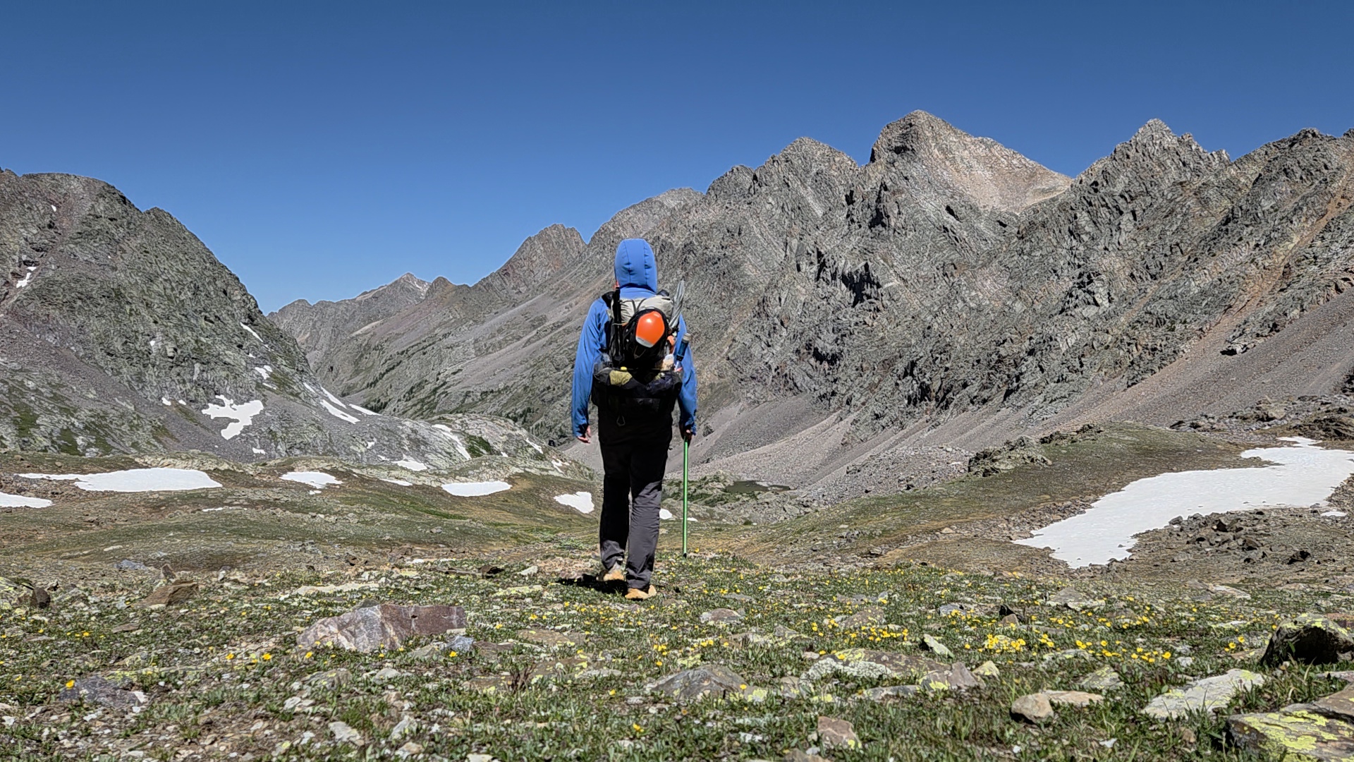
“The trail goes directly across the north slope. A slip could be catastrophic if you don’t self arrest quickly”
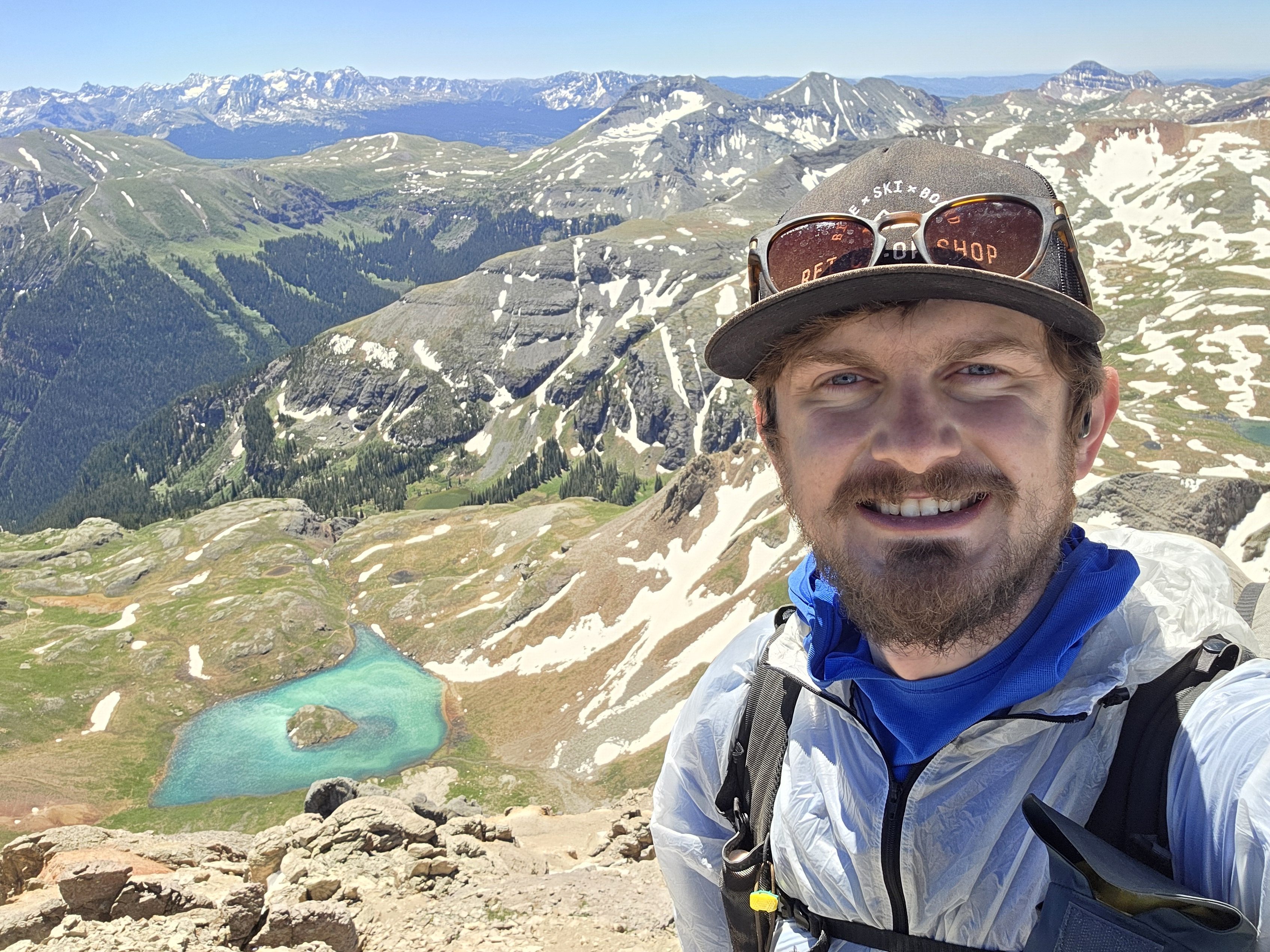
Donovan Rice has now been hiking the Great Colorado Route for 49 days and has walked approximately 622 miles.
His accounts during week 7’s hike included a ride on the Durango & Silverton Narrow Gauge Railroad (D&SNGR), exploring Durango’s charm, and navigating the trails near the Windom Group in the Weminuche Wilderness.
Catching the train to Durango
Day 42 started simple with Rice hiking along the Purgatory Flats Trail from Purgatory Mountain Resort east into the Needles Mountains, then followed the Animas River north to the Needleton Station train stop.
His goal was to catch a ride on the train heading south into Durango to resupply and relax in the iconic southwestern Colorado town.

Along the route, Rice was rewarded with the flowing blue waters of the Animas River and a bit of elevation ascension on the trail on his way to the train stop.
“I leisurely strolled up the Animas River and enjoyed the wooded terrain,” Rice said in his Day 42 social media post. “The thing is, I’m trying to explore the full breadth of Colorado hiking, and so it doesn’t always have to be at the top of a ridgeline, it could also be just a lovely river walk.”
An interesting fact about the Needleton Station is it was built in the early 1880s as a vital working point and resupply hub along the Denver & Rio Grande Western Railroad’s San Juan Extension. Although a flood wiped out the original town and station in 1927, the location serves as a popular backcountry stop, providing wilderness access for hikers and climbers heading into the Weminuche Wilderness and Chicago Basin.
Rice was glad he chose to ride the train instead of thumbing it to Durango.

“This (ride) is way more iconic,” Rice said. “You get to take a train out of the wilderness, and then later, I’m going to take the train right back to here. How cool is that to resupply via a wilderness drop-off train?”
Explore the charm of Durango town
Rice took the opportunity on Day 43 to experience a sunset soak at the Adobe Inn pool in Durango as well as do some chores around town.
“Durango is a lot like Golden but (with) foothills to the San Juans rather than the Front Range,” Rice said of Durango while relaxing and resupplying. “I needed to just vegetate/bedrot a little in my own quiet place away from the world. I really like the free public transit, and Homeslice Pizza, and Backcountry Experience had an impressive inventory.”
Rice also rode the trolley up and down Main Avenue.
“I got to meet some nice dogs and friendly locals while on the public transit,” Rice said in his Day 43 social media post.
Day 44 sure was day two of Rice’s “double zero” in Durango, and as luck would have it, was perfect because it rained a lot that day.

“There was some pretty nasty weather that I was happy to be here in town for rather than up in the high country,” Rice said.
But Rice was able to enjoy the day, chowing down on some food at the both the Durango Diner and Homeslice Pizza, plus checked out some of the local gear at stores like Backcountry Experience.
Rice has been exploring outdoor gear stores at nearly every town stop so far on the GCR.
Rice enters the Weminuche
On Day 45, Rice caught the D&SNGR train back to Needleton to reenter the wilderness.
After exiting the train with the nearly 40 other hikers who hitched the ride to Needleton, Rice decided to ascend Ruby Basin instead of following the horde into Chicago Basin.
Rice’s thinking would not disappoint either. It only became prettier and prettier as he ascended into the basin, looking at rock walls and spires all around.

But the scenery came with some cost.
“It’s worth mentioning that it’s actually quite an unpleasant trail through this area,” Rice said in his Day 45 social media post. “There’s a lot of overgrown willows, so you really have to work for your views.”

Rice found refuge in the high meadows under Pigeon, Turret and Animas peaks to close out the day.
Day 46 was a bit more of the same as Rice finished hiking Ruby Basin, but he also needed to make a choice before venturing too far one way or the other.
Rice said that Ruby Basin was vastly more rugged than Chicago Basin, but worth it.
He went over Twin Thumbs Pass and Ruby Pass, which directed him naturally into Noname Basin from the saddle.

“I just stumbled onto this route option when looking up beta for South Windom and saw someone did this route through Ruby over a decade ago,” Rice said. “I was really excited to see it goes!”
He then descended into the Twin Lakes area just west of the Windom Group of 14ers, the area where the peaks are usually accessed from.
Rice stayed busy throughout the day, staying above treeline nearly all day.

“I went up a saddle near West Windom, then up South Windom Peak down to Windom, Sundom and (finally) Sunlight Lakes,” Rice said. “Sunlight Lake is absolutely stunning.”
Rice ended his day trekking past iconic and one of the state’s “Centennial Peaks”, 13,833-foot Jagged Peak, before setting up camp north of the mountain.
On Day 47 Rice finished out most of the heart of the Weminuche High Route, passing Leviathon Peak, Storm King Peak and other high mountains, eventually linking up to the Colorado Trail (Segment 24, Stoney Pass to Molas Pass).

“I really enjoyed my modification of Ruby Basin to Twin Thumbs Pass,” Rice said. “I feel like that route is the most in the spirit of a high route compared to some other options I had available.”
He also became much more aware of the wildfires burning outside Ouray.
“Got my first glimpse of the fire from Highlands Mary Lake today,” Rice said. “I will evaluate if the fire impacts the Uncompahgre Wilderness section near Wetterhorn (after American Basin and Engineer Pass Road).”
Rice said, of possibly changing plans due to the fire, was would be to hike up Stony Pass back to the Colorado Trail and follow it until the La Garita Ridgewalk; a worst case scenario.
It’s called Silver-TON for a reason
Day 48 was supposed to be a chill hike day for Rice heading into Silverton. It became anything but that early on.
“I went up (and over) Sugarloaf into Spencer Basin,” Rice said. “Then (I did this) scary trail along a steep, north-facing (35°-37°) slope with some snow across Arrastra Basin. The trail goes directly across the north slope. A slip could be catastrophic if you don’t self arrest quickly.”

Rice survived, and after accomplishing the snow field, Rice descended down to Silver Lake and found some mining ruins, calming his nerves.
Silver Lake, which early settlers called Arrastra Lake, lies in a basin at the head of Arrastra Creek, four miles southeast of Silverton, Colorado, according to WesternMiningHistory.com.
In 1875 a handful of independent explorers made the ascent into the upper reaches of Arrastra Basin. In 1876, a man named John Reed became the first documented prospector to scout a route up the headwall.

According to Western Mining History’s account, Reed quickly found several veins that carried silver, lead, and copper on the flanks of Round Mountain. Silver Lake became a hot bed for mining operations thanks to one of Reed’s initial
According to Western Mining History’s account, the Silver Lake Mines Company reported 1891 revenues of $254,908 (about $6,800,000 in 2015) to the United States Mint, which at the time constituted approximately 25% of the total production of San Juan County.
“The Silver Lake Mine ruins are super cool,” Rice said. “Then you see a picture of what it used to look like and it all makes sense. Crazy how much nature has reclaimed the place.”

Rice made the last push toward Silverton by ascending westward into Woodchuck Basin, then over another ridge to Blair Gulch before connecting with County Road 20A into town.
“I decided walking into Silverton was more attractive than hitching from Stony Pass,” Rice said of his choice to tour the mining area. “So I did the ‘Silverton South Alt’ from the website. This is the Weminuche High Route proper.”

Rice had one last thought he shared about week 7’s hike.
“It’s been a slow week with the double zero day in Durango and low mileage on the (Weminuche) High Route,” Rice said. “I’m currently evaluating whether I want to hit Hensen Creek Road and just go up Nellie Creek Trailhead or do something different.”
What’s ahead for Rice
Rice will start week 8 off with a push out of Silverton, beginning to make his way toward American Basin and Handies Peak first.
Rice is also evaluating hiking the Redcloud Peak to Red Mountain Traverse (east northeast of Redcloud), “a very weather dependent route,” Rice said, then drop directly into Lake City.
Rice will make his way towards the Handies Peak Wilderness Study Area and Redcloud Peak Wilderness Study Area areas southwest of Lake City.
In his own words
Most satisfying moment from week 7
- “The most satisfying moment this week was successfully completing the Weminuche High Route,” Rice said. “High routes are no joke and will really test you, especially when working with very limited beta.”

Most challenging moment from week 7
- “The most challenging moment was an uphill bushwack from Elk Creek towards Verde Lake,” Rice said. “The area has a lot of beetlekill and deadfall, and my GPX route was wildly inaccurate, so it was a lot of dodge, dip, duck, dive, and dodging.”
What he’s learned from week 7
- “My biggest lesson of the week is to not blindly trust a random GPX track you downloaded from the internet,” Rice said. “The track I downloaded was a very hazy sketch of the overall route but wildly off base in going straight up and down impassable cliffs and thick willow fields.”
Discover more from Rocky Mountain Journal
Subscribe to get the latest posts sent to your email.