NASA and USGS continue 2-month long hyperspectral survey of 400,000 square miles from 12 miles above earth’s surface
For the better part of six weeks, NASA and the U.S. Geological Survey (USGS) have been flying a NASA aircraft 65,000 feet above earth’s surface, creating a digital portrait of critical minerals and geology in the American West, the USGS said in a May 12 press release.
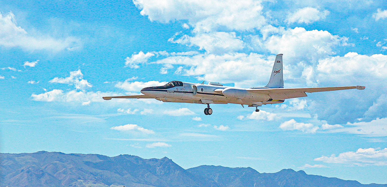
To perform the hyperspectral survey, the agencies have been flying a NASA ER-2 high-altitude plane, launched from Colorado Springs, Colorado, in order to identify mineral wealth over the western United States.
A hyperspectral survey is an advanced remote sensing technique that captures detailed data across hundreds of narrow, contiguous electromagnetic spectrum bands, according to USGS.
Once airborne, the aircraft uses instruments that measure dozens to hundreds of wavelengths of light, including ultraviolet, short-wave infrared and thermal infrared, reflecting off the Earth’s surface. The measurements then capture ‘spectral fingerprints’ scientists at the USGS analyze to identify minerals, according to USGS.
The last step in the process is a process called ground-truthing. Ground-truthing examines rocks in prospective areas detected from the edge of space, USGS said.
Field measurements then further refine the airborne data. According to USGS, using backpack-mounted spectrometers, they measure the same areas from the ground to account for atmospheric conditions and confirm mineral identifications.
The importance of the survey
The United States relied on imported sources for all the titanium it used in 2025, and at least 75% of the aluminum and 41% of the nickel it used as well, according to the USGS Mineral Commodity Summaries 2026, USGS said.
“Regaining America’s mineral independence takes a united effort starting with world-leading USGS mineral science and NASA aeronautics,” Andrea Travnicek, Assistant Secretary of the Interior for Water and Science said. “As of today, the hyperspectral survey from the edge of earth’s atmosphere has covered about 400,000 square miles, giving us a brilliant new picture of the mineral wealth under the western states.”
The hyperspectral survey is part of the USGS’s Earth Mapping Resources Initiative (Earth MRI) and is part of the Geological Earth Mapping Experiment (GEMx), a NASA-USGS partnership, according to the USGS.
Earth MRI works with the geological surveys of Colorado and 44 other states, educational institutions and industry to map critical minerals in the ground and in mine waste. Earth MRI data also yields other applications resulting from greater knowledge of the nation’s geology, USGS said, such as detailed data on water availability and hazards like landslides.
“This hyperspectral survey is one of the latest tools for a USGS mission that started in 1879: mapping the mineral resources of the United States,” USGS Director Ned Mamula said. “NASA flies the highest of all our cutting-edge Earth MRI surveys, which together show where to look for the minerals needed to drive the U.S. economy and national security.”
The USGS and NASA are continuing airborne imaging from California to the Rocky Mountain Front Range, USGS said, and are partnering with academic and commercial groups on targeted surveys of legacy mine sites.
“The Earth MRI hyperspectral campaign highlights the importance of continued investment in modern geoscience data collection across the western United States. Colorado’s complex geology makes the Rocky Mountain region an ideal area for advanced airborne mapping and remote sensing work,” Colorado Geological Survey Director Matt Morgan, who is president of the American Association of State Geologists, said.
“The information collected through these efforts can improve our understanding of critical mineral resources, water systems, and geologic hazards while supporting future geologic mapping and scientific research.”
The hyperspectral survey will continue until May 20, weather permitting.
Discover more from Rocky Mountain Journal
Subscribe to get the latest posts sent to your email.